- Acacias (Akáciák)
Leguminous plants (Fabales) of the Mimosaceae family; widespread in monsoon regions and savannas.
- Acidic non-podzolic soils (Savanyú, nem podzolos barna erdőtalajok)
Very acidic and shallow soils with some non-decomposed plant remains, formed under wood undergrowth of heather and cranberries.
- Acidic soil (Savanyú talaj)
Compact soil with poor aeration, drainage and nutrient availability, formed by the enhanced leaching of calcium carbonate under high precipitation. The pH values are below 6 but can be ameliorated by spreading calcareous sediments.
- Adaptive radiation (Adaptív radiáció)
Development of many species from a single founding species. The new species occupy new habitats and use locally available resources.
- Alkali meadows (Sziki rétek)
Meadows in low-lying lowlands. According to soil quality, the associations Agrostio stoloniferae-Alopecuretum pratensis and Agrostio stoloniferae-Glycerietum pedicellatae (on Class I soils); Eleochari-Alopecuretum geniculati (on Class II) and Agrostio stoloniferae-Beckmannietum eruciformis are found. On solonchak soils sedge and bent-grass vegetations grow.
- Alkali oak forests (Sziki tölgyesek)
Oak stands formed through the salinization of grove forests on higher ground. The forests are interrupted by alkali grasslands and meadows.
- Alkali soils (Szik, vagy szikes talaj)
Several soil types with the accumulation of soluble (mostly sodium) salts from salty groundwater, salt-containing soil horizon or from the decomposition of the soil. They are typical for grasslands and semideserts of alternating wetting and drying periods. Types are solonchak (soluble soda deposition on the surface), solonetz and solod.
- Allelopathy (Allelopátia)
In competition plant species use various chemical compounds to prevent the colonization of rival species in their vicinity.
- Allen’s Rule (Allen- vagy arányszabály)
Animals in cold environments have shorter extremities (limbs, ears) than those which inhabit warm environments.
- Alluvial chernozems (Öntés csernozjomok)
Soils where below the crumbly humous horizon (or even within that) alluvial layers of sand, silt and clay are found.
- Alluvial soils (Öntés talajok)
Soils without horizons where biological soil formation is hindered by regular floods and sediment deposition as the process repeatedly restarts on an ever new surface.
- Alpha diversity (α-diverzitás)
Species-level diversity, which shows how many species are found at different sites of the same habitat (community or ecosystem).
- Amelioration (Melioráció)
Improving soil quality through drain pipes, irrigation, stabilization of blown sand dunes and other techniques.
- Amelioration of alkali soils (Szikjavítás)
Measures to change the unfavourable properties of alkali soils, depending on soil type: carbonate, gypsum, lignite, rock powder or calcareous earth spreading and soil turning.
- Annual plant (Egynyári növény)
Plants which develop within a single growing season.
- Association (Asszociáció)
Unit in phyto- and zoocenology; community of plant and/or animal species occurring together. It has permanent composition and appearance.
- Autecology (Autökológia)
Ecological discipline studying the life styles and environmental requirements of individual plants.
- Autotrophs (Autotróf szervezetek)
Photosynthetizing organisms, which produce organic matter from solar energy, water and carbon-dioxide through chemical processes.
- Azonal vegetation (Azonális növényzet)
Vegetation type developed independent from zonal climate due to soil or hydrological factors (aquatic, swamp, bog, rock or sand vegetation).
- Banded brown forest soils (Kovárványos barna erdőtalajok)
Soil type formed on sand, with brown, red or reddish-brown stripes in the B horizon.
- Barren ground formation (Kopárosodás)
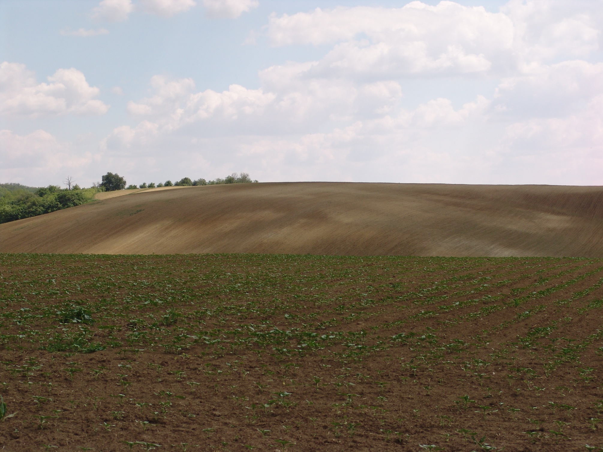
Erosion of the entire soil profile by natural processes and increasingly by human activities (deforstation, overgrazing, improper tillage).
Figure 5.1. Soil degradation: bare surface caused by intensive cultivation at Martonfa, Southern Baranya Hills. [photo by Gábor Varga]
- Barrier (Akadály)
Geographical phenomena blocking the dispersal of organisms.
- Beech forest (Bükkös)
Forest consisting predominantly of beech trees (Fagus silvatica). in the shade of the closed foliage the shrub layer is sparse and the moss layer is insignificant. In the submontane beech forests of low mountains beech is mixed with hornbeam, while at higher levels with mountain maple and fir.
Figure 5.2. Beech forest on the northern slope of the Eastern Mecsek Mountains near Kisújbánya [photo by Gábor Varga]

Figure 5.3. Beech forest in the Eastern Mecsek Mountains near the Lendület Spring [photo by Gábor Varga]

- Benthos (Bentosz)
Plants or animals which live on the bottoms of water bodies.
- Bergmann‘s Rule (Bergmann- vagy méretszabály)
The body size of animals in kinship grows moving from the Equator towards the poles (e.g. the emperor penguins near the South Pole are higher than 1 m, while Galapagos penguins, which live close to the Equator, are only 0.5 m high).
- Beta diversity (β-diverzitás)
The difference in species composition between two different habitats (eocsystem). Sum of species only present in one of the compared sites.
- Biocenology (Cönológia, vagy társulástan)
Discipline studying plant and animal communities, the regularities of their development.
- Biodiversity (Biodiverzitás)
The variability of living organisms and their environment, manifested at all levels of biological organization (genes, populations, communities, landscapes, biomes, biosphere).
- Biogeography (Biogeográfia)
Sciences of past and present geographical distributions of living organisms.
- Biological equilibrium (Biológiai egyensúly)
Dynamic stability in plant and animal communities (biocenoses), controlling its structure and operation. Self-regulation serves the maintenance of the community as a system.
- Biomass (Biomassza)
The mass of living material (measured in dried weight) present in an ecosystem at a given moment.
- Biomes (Biomok)
Extensive zones on the Earth, occasionally reaching beyond continents, which have similar climatic conditions and vegetation.
- Biosphere (Bioszféra)
1. The sphere occupied by living organisms on Earth (the upper lithosphere, pedosphere, troposphere and hydrosphere); its thickness is 15–16 km. 2. All the biota of the Earth with its habitat.
- Biotope (habitat) (Biotóp vagy élőhely)
Spatial location of a community (biocenose); the physical and biological environment of plant and animal communities of similar demand where they are found.
- Blind alkali flat (Vakszik)
The poorest agricultural alkali soils in Hungary.
- Bog (Láp)
Shallow depressions on the ground surface filled with water and usually without outflow; filled up with slowly decomposing organic matter (peat formation). Main types are marsh, raised bog, sphagnum bog, blanket bog.
- Bog soils (Láptalajok)
Soil type developed where the groundwater table rises to the surface or river inundations ensure a permanent water cover. There are two main types: acidic raised bogs, where under cool humid climate mosses absorb moisture and build up consequent layers raising the bog above its neighbourhood, and marshes, where the sedimentation of shallow lakes is combined with the accumulation of decomposing rests of aquatic vegetation (sedges, reeds, rushes).
- Brown earth (Raman’s brown forest soil) (Barnaföld, vagy Raman-féle barna erdőtalaj)
A type of brown forest soils, where clay contents in horizons A and B are similar (no lessivage or podsolizaton is observable), but higher than that of the parent rock. In Hungary typical of lower hills. The humic horizon is usually 20–30 cm deep, of brown colour, crumbly or angular structure, slightly acidic or neutral with gradual but short transition zone to the clay accumulation horizon, which is reddish brown from iron-oxide-hydrates.
- Brown forest soil with carbonate remnants (Karbonátmaradványos barna erdőtalaj)
Brown forest soil with weak leaching, therefore, acidification is moderate in the presence of carbonates.
- Caatingas (Caatingas)
Dry forests in the South American savanna.
- Calcareous earth spreading (Digózás)
Soil ameliarotation technique when fine calcareous sediments (mostly loess) are spread over the surface of acidic alkali soils.
- Calcareous-sodic alkali soil (Meszes-szódás szikes talaj)
Alkali soil which develops through the accumulation of sodium ions in the adsorption complex (clays) of calcareous soils. Salts move by capillary rise towards the surface and precipitate from the solution. The entire soil profile is calcareous and very basic (pH 8.3 to 9.5), unsuitable for arable farming, but can be used as grassland.
- Campos (Campos)
Savanna-type vegetation in South America with bottle-trunk trees. Continuous forests are only found along rivers.
- Catena (Katéna)
Cross-section, which shows the gradient of soil types and soil properties across the topography.
- Chernozem (Csernozjom, vagy mezőségi talajok, vagy feketeföld)
Zonal soils in the drier lowland regions of Hungary; typical with deep humous layer, rich in nutrients, of crumbly structure and high fertility, developed on carbonate-rich parent materials, primarily on loess, under continental climate and grassland vegetation. Main subtypes are alluvial, leached, pseudomycelian and meadow chernozems.
- Chernozem brown forest soil (Csernozjom barna erdőtalaj)
Soil in the contact zone of chernozems and brown forest soils, where leaching and humification are in balance. The deep humous layer often reaches down into the accumulation horizon. The clay contents in the leached and accumulation horizons are equal.
- Circumpolar distribution (Cirkumpoláris elterjedés)
Species or phenomenon found in a zone embracing the whole Earth.
- Citrus fruits (Citrusfélék)
Evergreen trees or shrubs of the Rutaceae family, mostly in tropical or subtropical regions. Endemic in Southeast-Asia, they are grown for their fruits of high vitamin C content (orange, tangerine, lemon, lime, pomelo, grapefruit etc.).
- Climax vegetation (Klimax növényzet)
The ideal (but often only theoretical, never realized) end-point of climax.
- Coevolution (Együttfejlődés, koevolúció)
Two unrelated species develop traits which spring from their interactions.
- Colonization (Megtelepedés, kolonizáció)
An expanding species establishes a self-sustaining population in a new region.
- Commensalism (Kommenzalizmus)
A kind of symbiosis from which one species benefits, while the other is not affected.
- Community (biocenose) (Biocönózis vagy életközösség)
Complex of all the different populations of constant combination of species, uniform ecological interactions and self-regulation (e.g. a temperate oak forest).
- Competition (Versengés)
Interactions between individuals of the same or different species in order to reach better positions for growth, reproduction or mortality).
- Coniferous forests (Tűlevelű erdő vagy fenyves)
Mostly evergreen plant association of wide tolerance in subarctic or high mountain environments of the Northern Hemisphere. There are few predominant tree species, the grass level is poor in species, the shrub undergrowth is absent. Main types are the taiga, fir, larch, Russian pine and Alpine forests. Conifers are predominant on acidic sand and debris surfaces.
- Conservation biology (Természetvédelmi biológia)
Discipline, which utilizes biological and other natural science rules to design strategies for the maintenance of biodiversity.
- Convergence (Konvergencia)
Unrelated species living in remote areas but in similar environments develop similar morphological and physiological traits.
- Cope’s Rule (Cope-szabály)
The rule according to which body size increases during the evolution of a taxon.
- Coral (Korall)
All polyps living in seas shallower than 200 m, water temperature higher than ca 20°C and secreting solid skeleta.
- Corridor (Folyosó)
Geographical contact between landscape ecological patches which promotes dispersal and colonization in further patches.
- Cosmopolitan species (Kozmopolita fajok)
Species which occur anywhere on the Earth in suitable environments. Among the plants they include weeds, among animals protozoans and insects.
- Deciduous or broadleaved forests (Lombos erdők)
Associations of trees and shrubs with protected buds and tree-rings under temperate climate. The leaves fall because of water deficit caused by cold weather. Main types are beech, oak, riparian and karst forests.
- Domestic animals (Háziállat)
Animals of economic benefit or other property valuable for human society, living around the house or in farms.
- Domestication (Háziasítás, domesztikáció)
Selection of plant and animal species selected by humans to provide them with some benefits. They are unable to survive on their own.
- Dominance type (Dominanciatípus)
Plant associations defined on the basis of one or more predominant species.
- Drog plants (Drognövények)
All medicinal plants affecting consciousness (e.g. coca, Indian hemp, hemlock, mandrake etc.).
- Ecology (Ökológia)
Synbiological science of the relationships and interactions between living organisms and their (abiotic and biotic) environments. It applies a systems approach and utilizes physical, chemical and biological laws.
- Ecosystem (Ökoszisztéma)
Structural and functional system of plants (producers of organic matter), animals (consumers) and other organisms (decomposers) and their abiotic environment. A self-regulatory open system.
- Ecotone (Ökotón)
A boundary strip of particular nature between two neighbouring ecotopes.
- Ecotope (Ökotop)
Ecological system, the spatial projection of a plant community and the corresponding animal community.
- Ecotype (Ökotípus)
Variety in the biota developed and established in different environments through adjustment (corresponding to subspecies in taxonomy).
- Endangered species (Veszélyeztetett fajok)
Species or subspecies at risk of extinction over the whole or part of its range, listed in a “red book“.
- Endemic species (Bennszülött, endemikus faj)
Plant or animal species which, under natural conditions, only occurs in its original range, which can be a continent or an area of only some square meters.
Figure 5.4. An endemic plant species in the Carpathian Basin: Paeonia banatica [photo by Gábor Varga]

- Environmental protection (Környezetvédelem)
Planned preservation of the habitats and life conditions of living organisms by human society; the exclusion of unfavourable influences from a deteriorating environment.
- Epiphyte (Epifita, vagy epifiton)
“Air plants“, which do not grow on the ground but on tree trunks or other plants (e.g. tropical orchids, mistletoe) and obtain water and nutrients from the residues of supporting plants or from falling dust.
- Erubase soil (Nyiroktalaj, vagy reliktum agyagtalaj)
Reddish soils with heavy clays and low humus content in the North Hungarian Mountains, formed through the weathering of rhyolite under conditions of abundant precipitation and high annual mean temperature. In the Pleistocene they incorporated dust (compacted into loess) to produce the most fertile soil of the Tokaj vineyards. Main processes of fomation: strong humification, weak leaching, neutral pH and crumbly structure. Extreme drainage prevents the growth of denser arboreous vegetation.
- Euryecious species (Tág tűrésű, euriök faj)
Species which withstand a wide range of environmental conditions (e.g. both on warm and cold climates).
- Euryhaline organisms (Sótűrő (eurihalin) szervezetek)
Terrestrial or aquatic species tolerating soils or waters, respectively, of a wide range of salinities.
- Eurythermic organisms (Hőtűrő (euriterm) szervezetek)
Terrestrial or aquatic species tolerating habitats of a wide range of temperatures.
- Eutrophication (Eutrofizáció)
Accumulation of nutrients for plants (primarily phosphorus and nitrogen compounds) in waters, indicated by masses of algae (“algal bloom“).
- Evolution (Evolúció, (törzs)fejlődés)
Genetically (inheritance) controlled biological process in the biota. Changes in the anatomy and behaviour of taxa and better adaptation to the environment by natural selection over time.
- Extinction (Kihalás)
The local or global loss of all individuals of a taxon.
- Extrazonal vegetation (Extrazonális növényzet)
Vegetation type formed within a biom due to local effects (e.g. slope exposure). An example is grassed slopes in the zone of deciduous forests.
- Fabaceous crops (Babfélék)
Vegetables in the beans (Fabaceae) family, rich in protein, used as human food, fodder and industrial raw material; best known examples are lentils, peas, soya and common beans, grown primarily in India and China.
- Fauna (Fauna)
All the animal species which live in an area.
- Flora (Flóra)
All the plant species which live in an area.
- Floral element (Flóraelem, vagy areatípus, vagy geoelem)
Totality of plant species in the same range and with similar demands. Types are 1) cosmopolitan, 2) adventive, 3) European (circumpolar, Eurasian, European, Central European), 4) continental, 5) Mediterranean, 6) Atlantic, 7) boreal, 8) Alpine, 9) Balkanic, Carpathian and Pannonian (endemic in Hungary).
- Food web (Táplálékhálózat)
Complex flow of energy between trophic levels of intertwined food chains.
- Forest (Erdő)
Arboreous vegetation type, including trees and shrubs. There are both zonal and intrazonal (gallery, grove) forests. The distribution of forests is controlled by water or heat deficit (polar areas, high mountains).
- Forest soils (Erdőtalajok)
Soils formed under arboreous vegetation types, mainly by leaching.
- Forest steppe (Erdős sztyepp)
Vegetation zone where deciduous (oak) or coniferous forests alternate with grasslands.
- Forested tundra (Erdős tundra)
Transitional zone between the tundra and taiga vegetations, characterized by forest patches of birch, spruce and larch.
- Fur animals (Prémes állatok)
All the animals which provide furs for industrial processing, including domesticated and wild animals.
- Gallery forest (Galériaerdő)
Riparian forest strip along watercourses.
- Gamma diversity (γ-diverzitás)
The total species richness over a landscape or a region, the product of alpha and gamma diversities.
- Generalists (Generalisták)
Species with wide tolerance, occuring at a wide range of habitats.
- Gley horizon (Gley-szint)
In areas where the subsoil is permanently saturated with water, anaerobic bacteria transform ferri-iron to ferro-iron and this gives a bluish-greenish taint to the soil, but later oxidizes to a rusty spot.
- Gold crown value (Aranykorona)
Measure of land quality in Hungary, introduced as the basis of taxation (net cadastral income) in 1875, when the crown was the official currency. Net income is calculated for each land use and land quality class. This system is still in use. The average value of 1 ha agricultural land in Hungary is 19 gold crowns (ak).
- Gravelly skeletal soils (Kavicsos váztalajok)
Soils on floodplains, alluvial fans and terraces of higher than 50 per cent gravel content, influencing their drainage and nutrient supplying capacity.
- Guild (Gild)
Group of species in a community which are similar in form, habitat and resource requirements.
- Halophytes (Halofita)
Plants tolerating salt-rich environments, growing on alkali soils.
- Hard-leaved forests and shrublands (Keménylombú erdők és cserjések)
Evergreen vegetation of trees and shrubs of Mediterranean regions with dermatoid and hairy leaves, rich in supporting tissue.
- Heath (Fenyér)
Plant community of heather (Ericaceae) plants, mostly evergreen, small-leaved shrubs and sub-shrubs, endemic under maritime climate and on acidic and leached soils poor in nutrients.
- Heavily eroded soils, entisols (Földes kopárok)
Eroded surfaces of exposed unconsolidated sediments without blocks of rocks. Humification only affects a shallow layer since material removal is continuous.
- Heterotrophic organisms (Heterotróf élőlények)
Non-photosynthetizing organisms which consume other organisms to acquire energy.
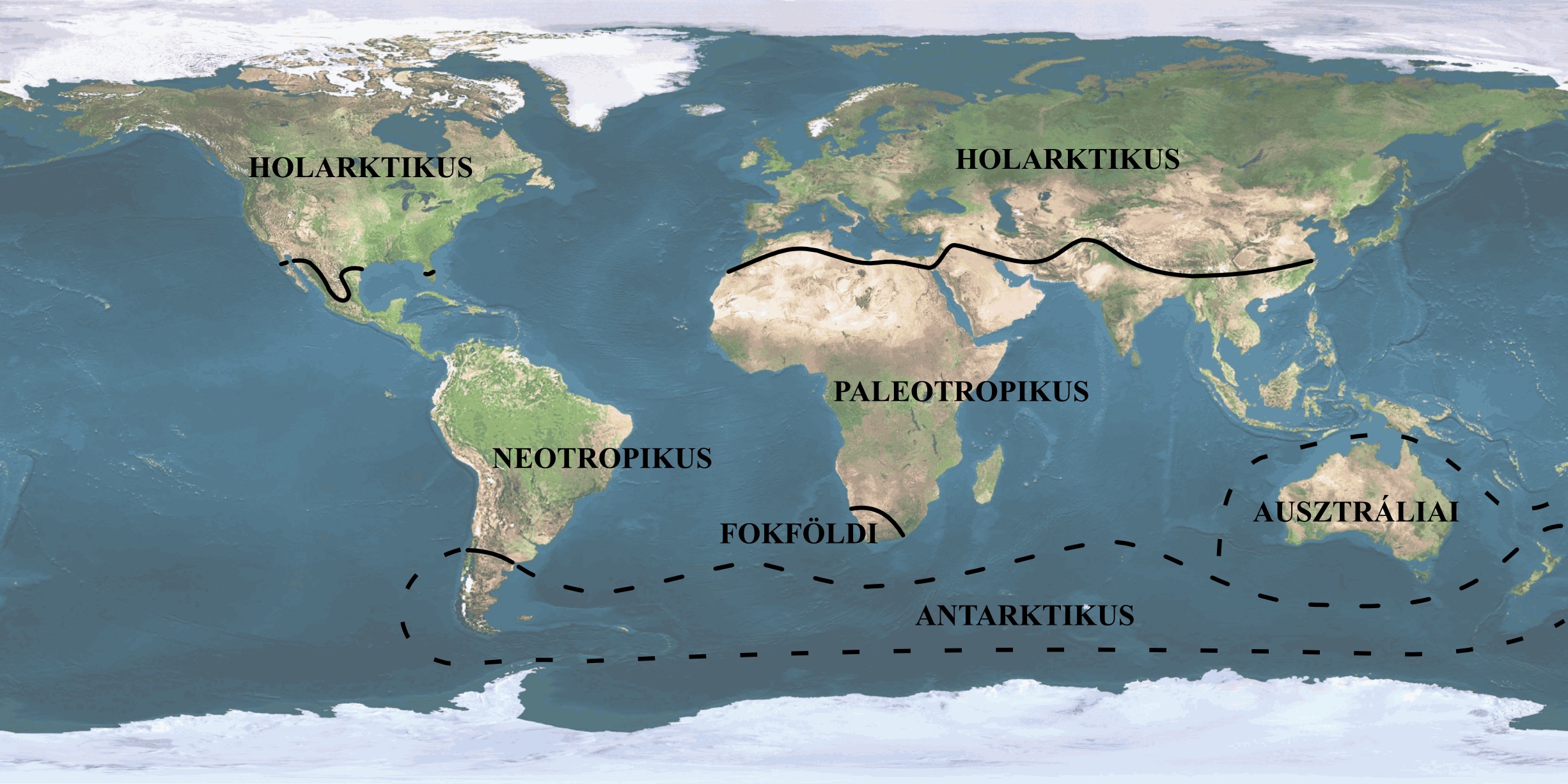
- Holarctic phytogeographic realm (Holarktikus flórabirodalom)
A realm of flora, including the northern extratropical continents (Europe, Mediterranean North Africa, Asia to the Himalaya and southern China and North America except Mexico and Florida. It is subdivided into 13 phytogeographic regions.
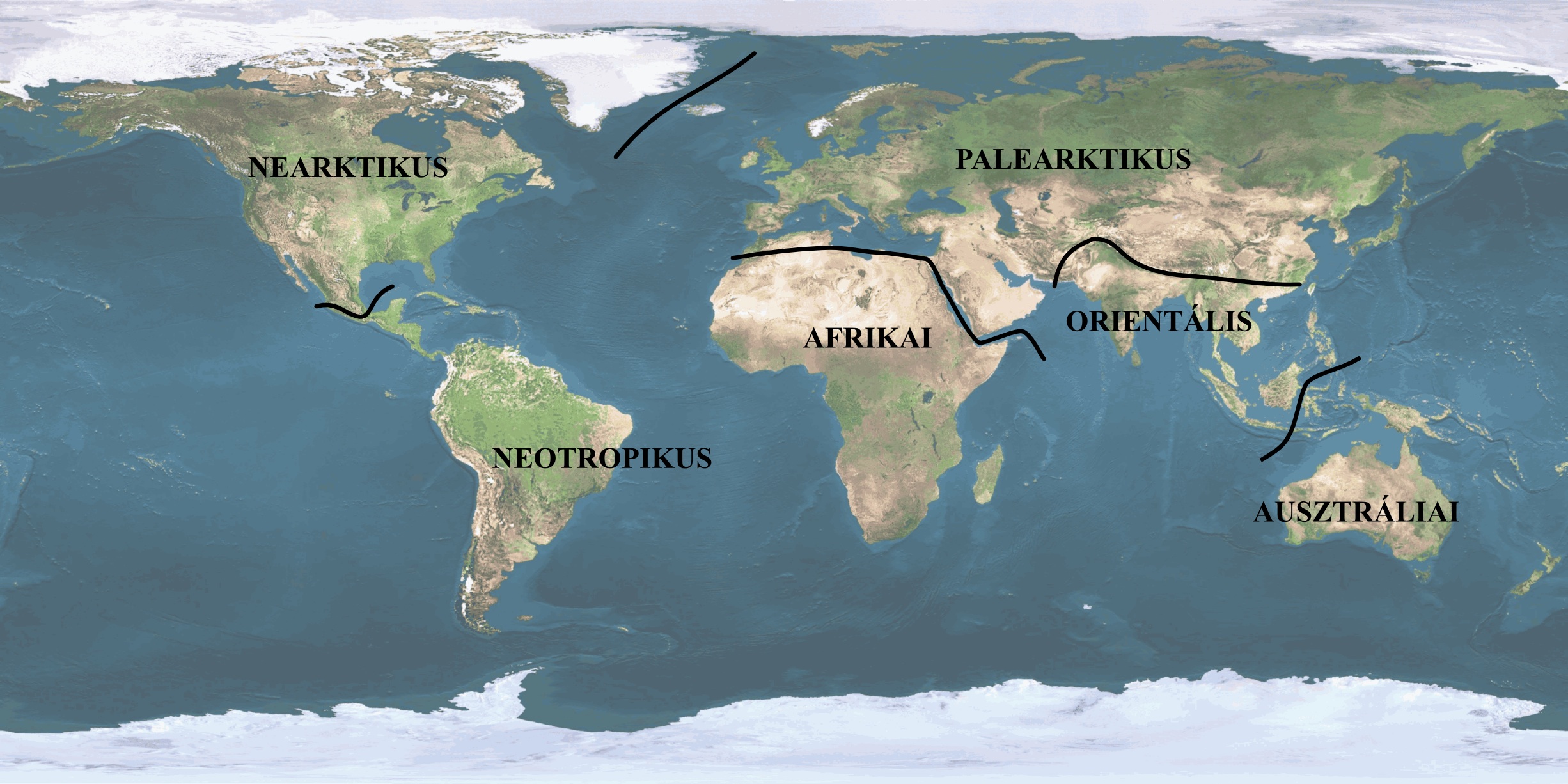
- Holarctic zoogeographic region (Holarktikus faunaterület)
The fourth region of Arctogaea, including North America to southern Mexico, Eurasia with North Africa, the Sahara and the northern Arab Peninsula.
- Hominids (Hominidák)
Individuals of humankind, now living and their extinct ancestors.
- Human ecology (Humánökológia)
An interdisciplanary study of the relationships between human individuals, communities and their physical, social and built environments.
- Human races (Emberi rasszok)
Taxonomical units within the single human species (Homo sapiens sapiens) based on variations in corporal properties. There are four major races (Europid, Negrid, Mongolid and Veddo-Australid) and numeorus minor races and groups.
- Humification, humus formation (Humifikáció, vagy humuszképződés)
Organic matter produced and transformed by plants and animals on the ground surface becomes attached to more or less altered mineral particles, soil components. A series of chemical process change plant and animal residues in the soil into humus.
- Humous sand soils (Humuszos homoktalajok)
Soil formation is restricted to the appearance of a humous layer less than 40 cm deep. Good permeability is coupled with better water retention capacity and higher fertility than in the case of sand soils.
- Humus carbonate soils (Humuszkarbonát talajok)
Soils of typically crumbly or angular structure, with a 20–50 cm deep humous horizon, formed on carbonate parent material (e.g. on loess). The transition between its horizons is abrupt. It develops on eroded surfaces where soil formation only reaches an early stage of humification.
- Industrial crops (Ipari növények)
Plants supplying industry with raw materials. In Hungary they fall into four groups: oil crops, fiber crops, food crops and other crops.
- Insularization (Elszigeteltség)
Development of communities in closed environment (e.g. on an island).
- Invasion (Invázió)
Rapid colonization of an agressive species (e.g. ragweed) in a new area, often unintentionally through human activity.
- Jungle (Dzsungel)
Almost impenetrable, swampy bamboo shrubland in India. In a wider sense any tropical rainforest with dense undergrowth.
- Karst shrub forest (Karsztbokorerdő)
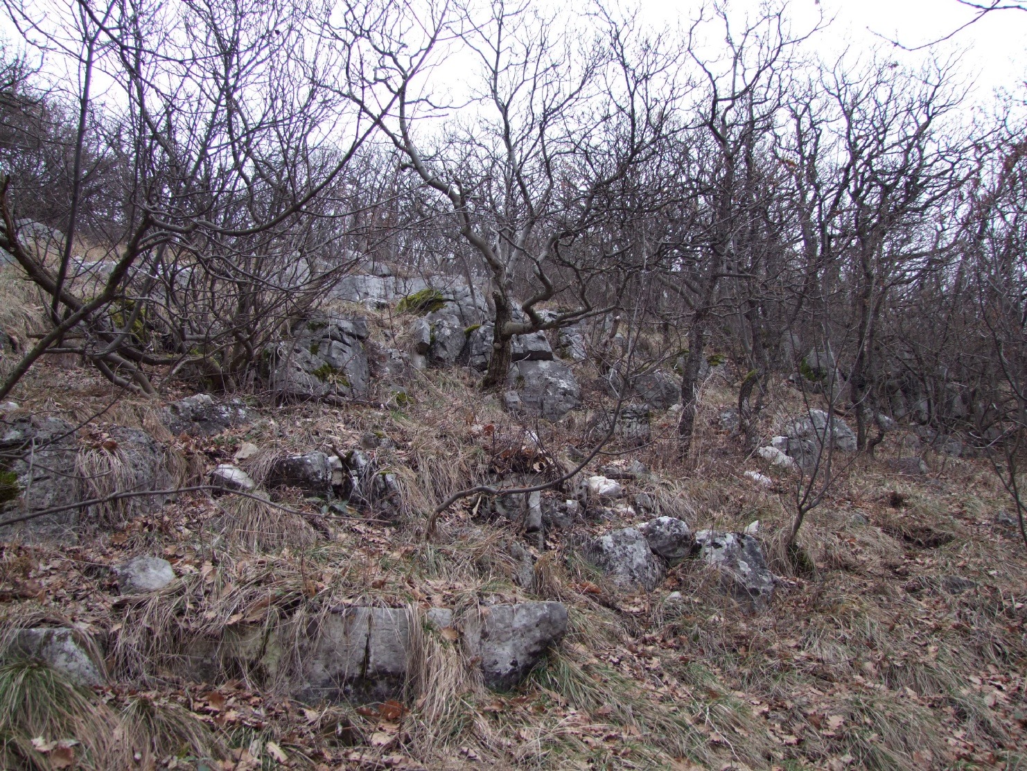
Association of downy oak (Quercus pubescens), wig tree (Cotinus coggygria) and manna ash (Fraxinus ornus) on limestone and dolomite slopes. Low (2–8 m high) trees and shrubs of open foliage alternating with grass swards.
Figure 5.8. Karst shrub forest on the steep southern slopes of the island of Brač, Dalmatian Coast. Hvar Island in the background [photo by Gábor Varga]
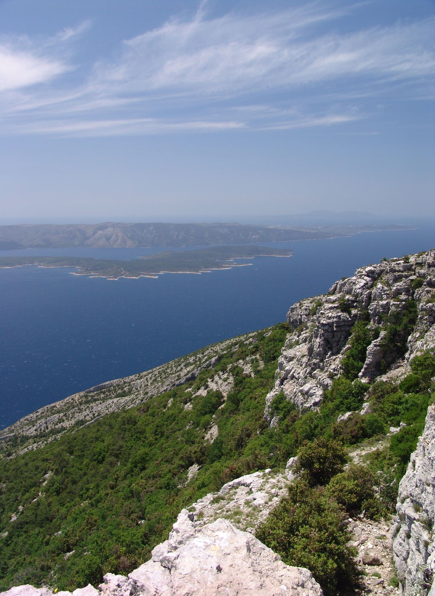
Figure 5.9. Karst shrub forest on the southern slope of the Mecsek Mountains, above Pécs, in winter [photo by Gábor Varga]
- Landscape ecology (Tájökológia)
Discipline studying the interrelationships between landscape pattern and functioning.
- Laurel-leaved forests and bushlands (Babérlombú erdők és cserjések)
Evergreen deciduous forests with loose foliage and bare, bright green leaves; typical of humid climate.
- Leaching (Kilúgozódás, vagy kilúgozás)
Removal of calcium-carbonate and other easily soluble compounds from the soil profile, formation of salts with alkali metals and alkali earth metals released during weathering. Not only carbonates but even silica can be leached. In a broader sense, leaching means the displacement of any soil compound from the A horizon to lower-lying horizon(s).
- Lessivation (Lessivage)
In acidic and humid environment clay particles move, without chemical transformation, from the A to the B horizon.
- Lianas (Liánok)
Herbaceous and arboreous plants which creep up on vertical supporting trunks, most often in tropical rainforests. In Hungary hop and birthwort are also lianas.
- Lithomorphic soils (Kőzethatású talajok)
Shallow soils, where soil properties are largely controlled by those of the parent material. Intense humification is characteristic but extreme hydrological conditions reduce the amount of water available for plants. Main types are humus carbonate soil, rendzinas, black erubase soils, rankers.
- Loam soils (Vályogtalaj)
Physical soil type where the 0.02 – 0.002 mm diameter grain size fraction is overwhelming.
- Loess oak forest (Lösztölgyes)
Woodland type of oak trees mixed with tatarian maple, once common along the contact zone of middle mountains and lowlands, not existing in Hungary today. All oaks endemic in Hungary and field maple, rich shrub undergrowth of blackthorn, hawthorn and privet and among grasses xerophytes (fescues) and species of forest steppes were typical in loess oak forests.
- Loess steppes (Löszpuszták)
Vegetation type in plains characterized by loess soils and typical vegetation (oriental species like Volga adonis, crambe), mainly in Asia, not found in Hungary today.
- Mangrove (Mangrove)
Vegetation type rooted in mud on tropical coastal floodplains, composed of few genera (Phizophora and Avicennia trees, Pandanus and Nipa palms).
- Maquis (Macchia)
Evergreen secondary shrubland under Mediterranean climate, even at higher elevations. High and dense shrub stands almost without any undergrowth.
- Marsh (Síkláp)
Last stage of lake infilling, developing to march forests in lower-lying areas and raised bogs on plateaus. Marsh associations are peat meadows, sedge meadows and rush meadows.
- Marsh forests (Láperdők)
Edaphic associations on swamp and bog soils, developed during the succession of lakes or wet meadows, due to high groundwater table in anaerobic environments.
- Meadow (Rét)
Grassland (also artificial) regularly mown and occasionaly grazed
- Meadow chernozems (Réti csernozjom talajok)
Soils with humification like in chernozems accompanied by a weak hydromorphous effect, resulting from surface waters or groundwater. Their structure is angular with short and abrupt transitions between horizons.
- Meadow soil (Réti talaj)
Soil type formed in low-lying areas to the influence of temporal wetting due to inundation or to the groundwater table close to the surface. Anaerobic conditions induce characteristic organic matter formation and the reduction of mineral components. Because of the slow decomposition of organic matter, dark or black colour and compact structure are typical, only suitable for cultivation after amelioration.
- Medicinal plants (Gyógynövények)
Plants or organs of plants which can be industrially processed into ingredient of a medicine.
- Mediterranean region (Mediterrán régió)
Biogeographical region of the Mediterranean region, which belongs zoogeographically to the Palaeoarctic province and phytogeographically the Holarctic realm. Its secondary vegetation is maquis and frigana.
- Monsoon forest (Monszunerdő)
Deciduous forest under seasonal monsoon climate, similar to savanna forests. Tress develop their foliage in the warm and humid season, while in the dry season they partially drop their leaves. Their grass undergrowth is composed of few species. Teak is a typical tree species.
- Muck (Kotu)
Decomposed or decomposing peat (often due to land drainage).
- Mutualism (Mutualizmus)
Symbiosis from which both species benefit.
- National park (Nemzeti park)
Category of nature conservation areas with the highest protection. An extensive area where protected plant and animal species and landscape elements with outstanding scientific, educational and recreational values occur.
- Nature conservation (Természetvédelem)
Social activity directed at the preservation of habitats, natural living communities and seminatural areas, landscapes; a totality of measures and actions aiming at the protection of nature.
- Nature Park (Naturpark)
Cultural landscape protected for its natural and aesthetic values and maintained by preserving management and ecotourism.
- Nature reserve (Rezervátum)
Protected area enclosed for the protection of rare and engangered plant and animal species in their natural environments.
- Nekton (Nekton)
Organisms which capable of changing their place on their own (e.g. fishes).
- Neotropic phytogeographic realm (Neotropikus flórabirodalom)
Central and South America from Mexico and Florida to the Argentinian pampas. It is subdivided into seven regions: the Caribbean, Orinoco, Amazonian, South-Brazilian, Andian, Pampas, Galapagos and Juan Fernandez Islands.
- Niche (Ökológiai fülke, niche)
The functional relationships of a species in the ecosystem; not a physical but a multidimensional resource space inhabited by the species.
- Nitrification (Nitrifikáció)
Oxidation of ammonia into nitrite by nitrifier bacteria to nitrite in well aerated soils and further to nitrate, available for plants.
- Notogaea (Notogaea)
Zoogeographic realm including Australia, New Guinea, the islands of Polynesia and Micronesia, where ancient primitive animals predominate, while higher (placental) mammals are absent.
- Oak forests (Tölgyesek)
Temperate forest type of variable composition (several oak species), mostly under continental climate with warm summers. In Hungary they include oak-hornbeam, loess, alkali, sand, Turkey, calciphile oak forests and karst shrub forests.
- Oligotrophic lake (Oligotróf tó)
Deep cold-water lake with abundant oxygen but low amounts of nutrient and, therefore, moderate primary productivity.
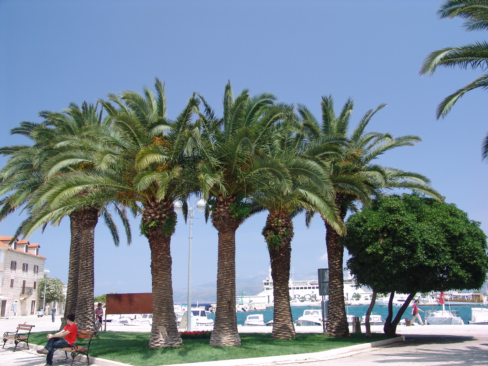
- Palms (Pálmafélék)
Tropical plant family (Arecaceae), including tree-size plants and tufted trees with trunks covered by leaf stumps and living leaves on the top of the trunk.
- Pampas (Pampa)
Extensive grasslands in temperate South America, particularly in Argentina (synonym for prairies and steppes). The sixth phytogeographic region of the Neotropical realm.
- Pandemic species (Pándemikus faj)
Species of wide distribution across biogeographical regions.
- Parasite (Parazita)
Organism in symbiotic relationship damaging its host.
- Pastureland (Legelő)
Regularly grazed grassland, including wooded pastures.
- Pedosphere (Pedoszféra vagy talajburok)
Geosphere formed from the lithosphere on the ground surface to the effect of the atmosphere, hydrosphere and biota.
- Perennial plant (Évelő növény)
Plants which develop over several growing seasons.
- Permeability (Permeabilitás)
Property that allows water to pass through soil or rock.
- Photosynthesis (Fotoszintézis)
The process of absorbing energy by plants as they produce simple sugars from water and carbon-dioxide to the effect of sunlight.
- Phylogenetics (Filogenetika, vagy törzsfejlődéstan)
Science studying the general laws of evolution, the foundation of paleontology.
- Phytocenology (Növénycönológia, vagy növénytársulástan)
The science studying the laws of plant associations.
- Phytocenose (Fitocönózis)
Plant community.
- Phytogeography (Fitogeográfia)
The geography of plants.
- Phytogeographic realm (Flórabirodalom)
The largest (supercontinental) unit in phytogeography, with uniform evolution and vegetation types. There are six phytogeographic realms on Earth: Holarctic, Palaeotropic, Neotropic, Australian, Capeland and Antarctic realms.
- Plankton (Plankton)
Totality of aquatic organisms freely floating in open water, including plants (phytoplankton) and animals (zooplankton). According to size macro (2 cm–1 mm), meso (1 mm–100 µm), micro (100–50 µm), nano (50–5 µm) and ultra plankton (<5 µm) are distinguished.
- Plant association, phytocenose (Növénytársulás, vagy fitocönózis)
Component of vegetation, the plant part of the biocenose, interdependent co-existence of individual plants and species.
- Plant geography (Növényföldrajz)
Science of the geographical distribution of the flora. It is engaged with the study of the composition of the Earth’s vegetation cover, its changes, life conditions and history.
- Ploughed horizon (Szántott réteg)
The uppermost, humous soil layer, loosened regularly by repeated tillage works.
- Podzol (Podzol)
Leached soil, poor in nutrients, formed under cool humid and acidic conditions under coniferous forests (taiga). The Russian name refers to the grey colour of accumulated silica. Iron and aluminium and organic matter are leached into the B horizon, where they accumulate.
- Polygonal tundra (Poligonális talajok)
In the polar belt cryoturbation and other regelation processes lead to sorting and separation of fine and coarse soil components. This is mnaifested on the surface as polygons.
- Population (Populáció, népesség)
All individuals of a plant or animal species, which live in the same area at the same time and are capable of frequent interacting and interbreeding.
- Prairies (Préri)
Extensive grasslands in North America, a phytogeographic region of the Holarctic realm.
- Predation (Predáció)
A kind of biological interaction in which one organism consumes the other.
- Production site (Termőhely)
The totality of environmental conditions at a site where some crop is grown.
- Protected landscape (Tájvédelmi körzet)
Second highest category of nature conservation in Hungary. Larger and contiguous landscape section of great natural and aesthetic value. Establishments alien to the landscape are generally prohibited, but economic activities (agriculture and forestry) which do not interfere with landscape character are allowed.
- Pseudogleyic brown forest soils (Pszeudoglejes (pangóvizes) barna erdőtalajok)
Very acidic soils with reductive soil formation and stagnant infiltrated water above an accumulation horizon of low permeability. The leached horizon has a pale colour, while the brown to yellowish brown accumualtion horizon shows marble-like grey stripes and rusty iron-oxide spots.
- Pseudomycelian chernozem (Mészlepedékes csernozjom talajok)
In this light greyish, crumbly, fertile soil the skeletal particles are covered by fine white veneers of carbonate, similar to fungus hyphae (hence is the name). Pseudomycelia result from a particular seasonal dynamics: leaching prevails from autumn to spring and precipitation and pseudomycelia formation during the summer drought.
- Puszta (Puszta)
Treeless grassland under warm temperate climate with moderate precipitation and the corresponding vegetation type.
- Puszta oak forests (Homoki tölgyesek, vagy pusztai tölgyesek)
Vegetation type with pedunculate oak as the predominant tree species; developed from the Convallario-Quercetum association due to sinking groundwater table. Climax association in the sand regions of the Great Hungarian Plain, degraded to form juniper forests with poplars and birches.
- Puszta shrubs (Pusztacserjék)
Plant communities typical of the forest steppe zone with Russian almond, hawthorn and secondary degraded shrublands of blackthorn and hawthorn, gradually disappearing from the Hungarian Great Plain.
- Race (Fajta vagy rassz)
Plant or animal groups created by breeding. The genetic divergence between races is less than between races.
- Rainforest (Esőerdő)
Evergreen forest of several (5 to 7) storeys composed of trees with shiny and bare leaves and free buds in hot tropical environments.
- Raised bog (Felláp)
Bog built by mosses.
- Range (Area)
Area permanently occupied by a taxon.
- Ranker soils (Ranker talajok)
Shallow soils with poor drainage and unfavourable nutrient budget on solid soliceous rocks.
- Red soils (Vörösföldek)
Red clay soils formed under subtropical warm and humid climate. The characteristic red colour is due to the irreversible coagulation of iron-oxides. Red soils are poor in humus and silica, while iron and aluminium hydrates are enriched in them. Good climate indicators.
- Reed-beds (Nádas)
Vegetation type reaching 2 m down into the water of lakes. The common reed (Phragmites australis), which belongs to the Poaceae, grows in high and dense stands, sometimes replaced by rushes.
- Relict species (Reliktum, vagy maradványfaj)
Plant or animal species of former geological epochs restricted to small (refuge) areas under altered climate and endangered by extinction.
- Rendzina (Rendzina)
Shallow (20–25 cm deep) soils with high humus content and poor leaching, formed on limestone or dolomite parent materials.
- Residual community (Reziduum)
Group of organisms remaining from earlier geological epochs, constituted of relict species.
- Revolutionary change (Revolúció)
As opposed to slow evolutionary change, rapid transformation resulting in a new quality.
- Riparian forests (Ligeterdők)
Edaphic woodlands (like gallery forests) along streams and rivers on soils rich in oxygen and freshwater, inundated in springs.
- Riparian vegetation (Vízparti növényzet)
Vegetation stripes along watercourses and lakes developed through succession.
- Root crops, tuberous plants (Gyökérnövények, vagy gyökérgumósok)
Crops grown for their thickened roots and tubers (e.g. potato, beets).
- Sand soils (Homoktalajok)
Soils with more than 45 per cent sand fraction in grain size composition.
- Sand soils (blown) (Futóhomok és jellegtelen homoktalajok)
Formations with no diagnostic characteristics of soil formation (humification, lessivage, mineral transformation and accumulation). The lack of vegetation cover hinders humification. Due to rapid water absorption and liability to desiccation the sand is easily mobilized.
- Savanna (Szavannák)
Biome between the tropical deserts and equatorial rainforests, where temperatures are high throughout the year but precipitation only fall in summer. Grasslands alternate with groves of trees, which drop their leaves in the dry season. The South American savannas are called llanos or cerrado.
- Sclerophyllous plants (Szklerofil növények)
Plants with hard and waxy leaves and stomata hidden in pits. All these features serve the preservation of moisture.
- Scrub (Scrub)
Secondary vegetation of widely spaced shrubs created by deforestation or overgrazing under Mediterranean and subtropical monsoon climate, previously vegetated by hard-leaf forests. Local names are mulga and mallee.
- Scrub forest (Bokorerdő)
Closed plant association with low trunk arboreous plants (shrubs).
- Serozem (Szerozjom)
Typical grey soil of semideserts with low (1 to 3 per cent) humus content. The A horizon is rich in calcium carbonate, while the B horizon abounds in clay minerals.
- Skeletal soils (Váztalajok)
Soil group where the effect of biological processes is limited, due to rapid surface dynamics (erosion, deflation) or the properties of the parent material. Main types are: stony, rocky, gravelly skeletal soils, heavily eroded soils, blown sands and poorly developed sand soil, humous sand soil.
- Smolnitza soils (Szmolnyicatalajok)
Pitch black, usually clayey, polygonal soils fromed on weathered andesite.
- Sodic soils (Szódás talajok)
Basic soils (pH > 8.3) with soda (Na2CO3) and other salts. As humus dissolves in soda, runoff from sodic soils is of dark colour.
- Soil (Talaj)
The outermost, loose and fertile layer of the Earth’s crust, a formation of complex origin, source of nutrients for organisms. A three-phase disperse system, formed through the physical, chemical and biological weathering of surface rocks.
- Soil amelioration (Talajjavítás)
Changing the unfavourable soil characteristics through converting soils of reduced fertility into cultivable soils by means of agrophysical (tillage), agrochemical (fertilization, carbonate spreading) and agrobiological (crop rotation, manuring) amelioration techniques.
- Soil degradation (Talajdegradáció)
Decrease of the nutrient and humus content and, consequently, fertility of soils to the effect of some external natural factor or social activity. Removal or quality deterioration of soils.
Figure 5.15. Slopes in the Dolomites (Southern Alps) affected by rill and gully erosion [photo by Gábor Varga]

- Soil erosion (Talajerózió vagy talajlepusztulás)
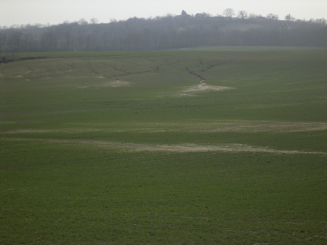
Gradual thickening or complete removal of the fertile A horizon by agents like water, wind and various mass movements.
Figure 5.16. Rill erosion on the eastern margin of the Marcali Ridge, Inner Somogy Hills [photo by Gábor Varga]
- Soil geography (Pedogeográfia)
Science of the distribution of soils.
- Soil horizons (Talajszint)
Distinct genetic soil units, differing in colour, structure and humus content, resulting from soil formation processes. A, B and C horizons and their subhorizons are distinguished.
- Soil profile, solum (Talajszelvény)
Usually 1.5–2 m deep, vertical section, exposed to study soil morphology. It is subdivided into horizons diagnostic of soil formation and properties.
- Soil science, pedology (Talajtan, vagy pedológia)
Science of soil formation, evolution and distribution, including the disciplines of soil biology, soil physics, soil chemistry, soil genetics, soil classification or taxonomy, soil mapping, the geology and geography of soils.
- Soil structure (Talajszerkezet)
Spatial arrangements of solid soil material. Its types are structureless, shelly, nuts, crumbly, laminar, polyhedral, columnar, angular and powdery structures.
- Soil texture, physical soil type (Talajszövet vagy fizikai talajtípus)
Certain grain size class which, along with subsidiary properties, characterizes the soil: skeletal, sand, loam, silt and clay soils.
- Soil turning (Rigolírozás)
Amelioration technique for alkali soils involving digging and turning by the plough to depth below 50 cm, coupled with drainage/irrigation canals to optimize drainage conditions.
- Soil types (Talajtípusok)
There are soils under the influence of bedrock, climate and vegetation, which are biological, chemical and physical processes in respect of the same. Therefore, soil types are said genetic or biological, physical and chemical.
- Solod (Szology)
Alkali soil type with white powdery precipitation (silica, SiO2) on the soil surface or in the A horizon, while in the B horizon iron oxides form concretions. It is common in seasonally inundated depressions.
- Solonchak (Szoloncsák)
Basic alkali soil type with precipitation of sodium salts (Na2CO3) at or near the soil surface and very poor drainage. The profile does not show horizons.
- Solonetz (Szolonyec)
Alkali soil type with a pale and hardly permeable A horizon, a B1 horizon of variable structure and with extreme physical and chemical properties (high clay content, compaction, very basic reaction). Maximum sodium salt accumulation is at greater depths of the soil profile. Most of the alkali soils in the Hungarian Plains are solonetz.
- Specialist species (Specialista faj)
Species with a narrow range of resource tolerance and a small niche.
- Species (Faj)
In an evolutionary sense, all individuals which have common ancestors and have at least one diagnostic character which is present in all members of the species but absent in other organisms. In a biological sense, the totality of populations the members of which are of similar appearance and can sexually reproduce without restriction.
- Species richness (Fajgazdagság)
The number of species occurring in an area. An important measure of biodiversity.
- Sphagnum bog, raised bog (Mohaláp, vagy felláp, vagy tőzegmohaláp, vagy dagadóláp)
Under cool climate, on soils poor in nutrients, masses of Sphagnum moss, fed by rainwater, accumulate. A convex raised bog is formed from the superimposition of peat layers.
- Spices (Fűszernövények)
All crops which are used for tasting and colouring food and drinks. Its effective ingredients enhance metabolism.
- Stand (Állomány)
Group of plants uniform from certain aspect (e.g. age), particularly trees in a forest.
- Stenoecious species (Szűk tűrésű, sztenoök faj)
Species which withstand only a narrow range of environmental conditions (e.g. plants preferring moist, cool and shaded sites).
- Steppe meadows (Pusztai rétek, vagy sztyepprétek)
Vegetation type typical of dry continental regions. More or less closed grasslands with strong supporting tissues in prevailing plants. The organs above ground die in autumn.
- Steppes (Sztyepp)
Treeless vegetation type of temperate semiarid areas, named steppes after the extensive Russian grasslands, the Hungarian equivalent being puszta, the North American prairies, the South American pampas. Main types are the forest steppe; the northern or high grass steppe; southern or low grass steppe; semidesert vegetation.
Figure 5.19. Sand grassland vegetation with feather grass (Stipa borysthenica) in the Ürge Meadow, Paks [photo by Gábor Varga]

- Stepping stones (Lépőkövek)
Discontinuous ecological corridor. Islands or discrete habitat patches of similar character which promote the dispersal of a species.
- Stony, rocky skeletal soils (Köves, sziklás váztalajok)
Soil type formed in mountainous and heavily eroded sites where parent material weathering is not sufficient to supply nutrients and water for the colonization of plants. Soil depth is less than 20 cm and alternates with barren parent rock spots.
- Subarctic phytogeographic region (Szubarktikus flóraterület)
Zone of coniferous forests under subarctic climate with cold winters and cool summers and water surplus. Most typical and common species are spruces, larches, firs, birches and willows.
- Subsoil (Altalaj)
Generally the non-ploughed, lower (B and C) soil horizons.
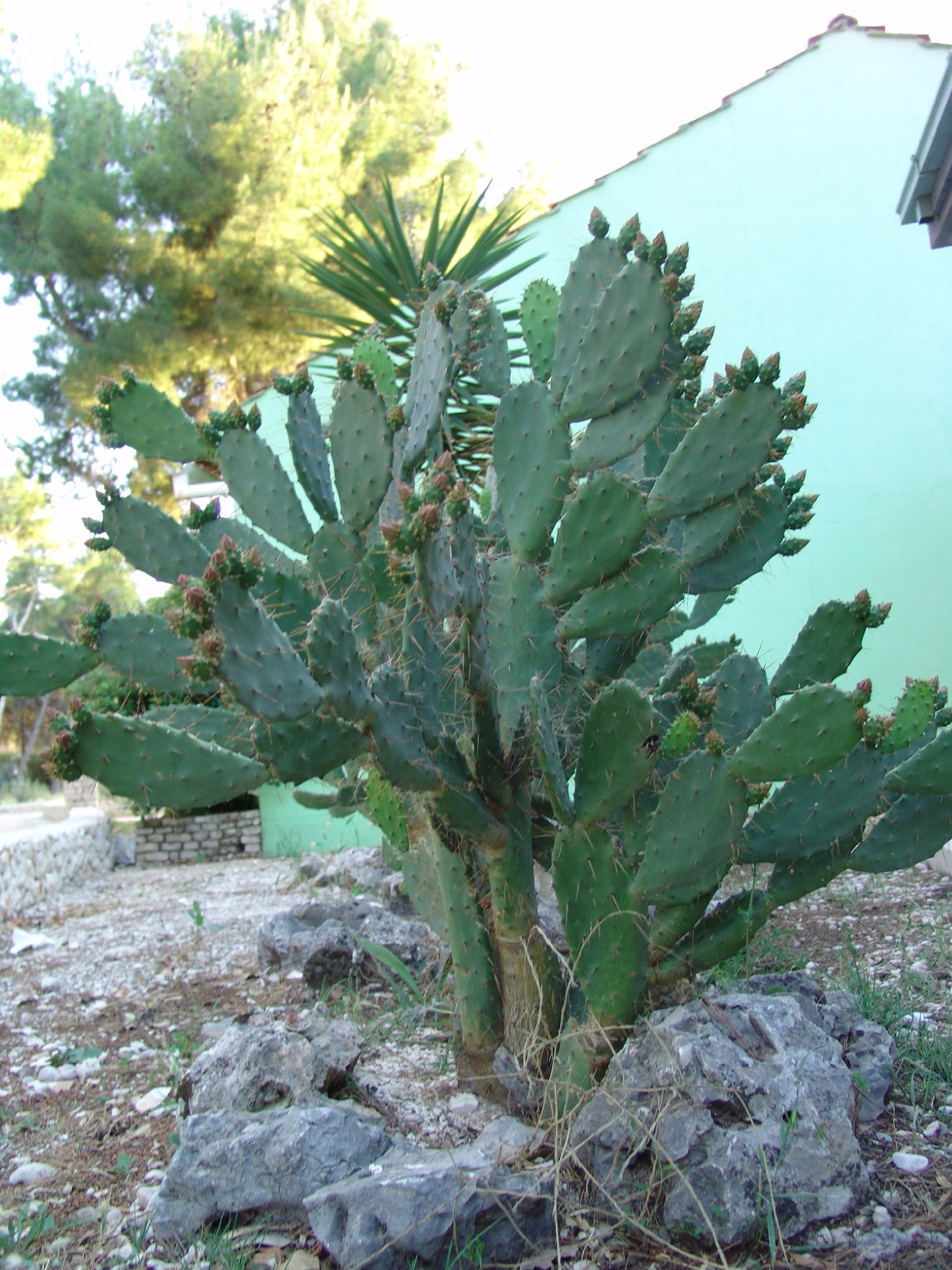
- Succulent plants (Pozsgás növények)
Plants with leaves and stems modified to store water in arid environments.
- Succession (Szukcesszió)
Slow natural evolution when in an area plant associations follow each other in a sequence until a climax association, with maximum organic matter production possible in the given environment.
- Symbiosis (Szimbiózis)
Close interrelationship between two species, generally developed through coevolution. It is vital for one or both species.
- Synecology (Szünökológia)
Ecological discipline studying the characteristics of vegetation cover and plant associations.
- Swamp (Mocsár)
Shallow standing water with predominant reed, sedge and water-lily vegetation. Swamps are in an advanced stage of lake evolution, when vegetated surfaces surpass open water surfaces.
- Taiga, boreal forest (Tajga)
Extensive coniferous forests (primarily spruces, firs and Siberian pine) in the subarctic regions of Eurasia and North America.
- Takir, salt clay pan (Takír vagy sós agyag)
Lacustrine salt and clay accumulation on the bottom of desiccated and filled salt lakes of the internal basins of Asia. When drying out, a polygonal network of cracks appears on the surface. No horizons are distinguished and, therefore, the takir is not regarded a soil type by some experts.
- Taxon (Taxon)
Taxonomic unit of any level.
- Terra rossa (Terra rossa vagy vörösföld)
Red soil of limestone areas in the warm temperate, subhumid and Mediterranean regions, weathering (solution) residue with ferri-iron, little humus and heavy leaching.
- Topsoil (Feltalaj)
1. Naturally formed soil on some parent material. 2. The uppermost (A) soil horizon.
- Tundra (Tundra)
Arctic vegetation type on flat or hummocky surfaces, characterized by mosses, lichens and dwarf shrubs on permafrost, frozen in winter and thawed to various depths and swampy in summer.
- Tussock (Zsombék)
High sedge vegetationin bogs with enduring inundation or on permanently waterlogged soils.
- Unconfined groundwater (Talajvíz)
Subsurface water body above the uppermost aquiclude and in contact with the atmosphere and rainwater. Consequently, its physico-chemical and hydrogeological properties are highly changeable and it is susceptible to contamination from the surface.
- Vicariant species (Vikariáns fajok)
Substituting species. Species in kinship occur in similar environments but in different areas (continents) (geographical vicariance) or in the same area but in different environments (ecological vicariance).
- Xerophile animals (Xerofil fajok)
Animals tolerant of dry climate.
- Xerophytes (Szárazságtűrő növények)
Plants growing on dry soils in regions with low precipitation, under dry climates sclerophytes and succulents, while on colg (frozen) soils the cryophytes grow.
- Xerotherm species (Xeroterm fajok)
Plants or animals under warm and dry climate.
- Zonation (Övezetesség)
Zonal arrangement of physical environments and the biota caused by solar radiation and various modifying factors.
- Zonal vegetation (Zonális növényzet)
In flat area vegetation zones (biomes) are adjusted to climatic belts.
- Zoogeography (Állatföldrajz)
Discipline which studies the geographical distribution of animals.
- Zoogeographic realm (Faunabirodalom, vagy gaea)
The largest, supercontinental, unit of zoogeography for land and freshwater animals. There are four zoogeographic realms on Earth: Notogaea, Neogaea, Arctogaea and Antarctogaea. Subdivided into regions and provinces.
