- Abandoned channel (Holtmeder)
A former stream channel through which water no longer flows. Produced naturally (by cut-off) or artificially (during channelization), it receives water only at very high water stages.
- Abyss (Mélytenger)
Pertaining to the ocean environment or depth zone of 800 m or deeper and its organisms.
- Abyssal zone (Abisszikus öv)
The part of the ocean where light does not reach. The abyssal zone lies below approximately 2000 meters with the position of the 4°C isotherm generally considered the boundary with the bathyal zone that lies immediately above. Abyssal organisms are adapted to life under high pressures and in cold, dark conditions.
- Acidulous water (Borvíz)
Mineral water either with dissolved carbonic acid or dissolved sulfur compounds such as sulfates.
- Active floodplain (Hullámtér)
Lands adjacent to the stream inundated during overbank flow.
- Alkaline lakes (Szikes tavak)
Lakes where evaporation concentrates the naturally occurring alkali salts, often forming a crust of mildly basic salt across a large area. Salt concentration ranges between 0.6 and 7 g/L and pH is basic. Salts crystallize in beds during summer drought. In interdune depressions or wind furrows limnic limestones may also precipitate in alkaline ponds.
- Aquifer (Víztartó réteg)
An underground layer of water-bearing permeable rock or unconsolidated materials (gravel, sand, or silt) from which groundwater can be usefully extracted using a water well.
- Archipelago (Archipelagus)
A chain or cluster of islands. It is now used to refer to any island group of the same origin or, sometimes, to a sea containing a large number of scattered islands such as the Aegean Sea.
- Artesian well (Artézi kút)
A well deriving its water from an artesian or confined aquifer, which under the pressure of overlying rock strata. Usually occurs in basins. In positive artesian wells the groundwater rises to the surface. The first artesian wells were dug in the province of Artois, France, in 1226.
- Autopurification (Vizek öntisztulása)
If pollution does not attain a critical level, water can purify itself, i.e., progressively eliminate polluting agents.
- Avalanche (lavina)
A sudden rapid flow of snow and ice down a slope with characteristic sound ♫. Typically occurring in mountainous terrain.
- Baer's law (Baer-törvény)
Named after Karl Ernst von Baer, it claims that, because of the rotation of the earth, in the Northern Hemisphere, erosion occurs mostly on the right banks of rivers and in the Southern Hemisphere on the left banks. Published in 1856, the law fails to calcualte with diversion for latitudinal rivers. In 1860 Baer corrected his law.
- Balneology (Balneológia)
The science of baths or bathing, especially the study of the therapeutic use of thermal baths. Medical waters have beneficial effects due to their mineral contents. Balneotherapy is widely used in clinics.
- Bar (Zátony)
A somewhat linear landform within or extending into a body of water, typically composed of sand, silt or small pebbles. Classified by location, shape and material.
- Bathometer (Bathometer)
An instrument used to measure the depth of water, ranging from a simple plummet to sonars (sound navigation and ranging), which are based on sound wave reflection.
- Bathyal zone (Batiális öv)
Upper part of the ocean, which lies on the continental shelf at a depth of between 200 m and 2000 m and has a constant temperature. Mud-dwelling organisms predominate.
- Benthos (Bentosz)
The community of organisms which live on, in, or near the seafloor (animals down to 6-10 km depths), also known as the benthic zone. Includes wildlife from tidal pools along the foreshore to the continental shelf, and then down to abyssal depths.
- Bog (Láp)
A wetland that accumulates peat, an acidic deposit of dead plant material—often mosses or, in Arctic climates, lichens. Gradual accumulation of organic material and its transformation to peat is typical.
- Brackish water (Brakkvíz)
Water that has more salinity than fresh water, but not as much as seawater. It may result from mixing of seawater with fresh water, as in estuaries, or it may occur in brackish fossil aquifers. The largest brackish water body is the Baltic Sea.
- Breaker (Hullámtörés)
A wave whose amplitude reaches a critical value and makes it collapse. Wave energy is suddenly transformed into turbulent kinetic energy which causes wave erosion.
- Brook (Ér)
A small stream, directly fed by a spring or seep. A brook is characterized by its shallowness and its bed being composed primarily of rocks. Mean discharge is below 0.5 m3/s, water regime is extreme.
- Canal (Csatorna)
Man-made channels for conducting water. There are two types of canal: waterways between rivers and lakes and aqueducts.
- Canalization (Csatornázás)
The process of introducing weirs and locks to a river so as to secure a defined depth suitable for navigation
 .
.- Catchment area (Vízgyűjtőterület)
An extent or an area of land where surface water from rain and melting snow or ice converges to a single point, usually the exit of the basin.
- Centreline (Középvonal)
The median line of a stream at equal distance from both banks along the axis of the valley.
- Channel (Meder)
The bed where a natural body of surface water flows or may flow; a natural passageway or depression of perceptible extent containing continuously or periodically flowing water.
- Classification of water (Vízosztályozás)
Based on the origin, location, temperature, or chemistry of water. By origin, waters are juvenile or vadose. Groundwater types are distinguished by their location, while thermal and mineral waters are defined by physical and chemical properties.
- Coastline (Part)
The line that forms the boundary between land and water, esp. the water of a sea or ocean.
- Confined groundwater (Rétegvíz)
Ground water under pressure significantly greater than that of the atmosphere. Its upper surface is the bottom of an impermeable bed or a bed of distinctly lower permeability than the material in which the water occurs.
- Continental shelf (Self)
Very gently sloping (0.1°) part of the continental margin between the shoreline and the continental slope (to a depth of 200 m).
- Cooling lake (Hűtőtó)
Heat removal devices used to transfer process waste heat to the atmosphere. An artificial lake, reservoir (e.g. Markaz Lake).
- Cooling tower (Hűtőtorony)
Heat removal devices used to transfer process waste heat to the atmosphere. Hyperbolic-shaped towers in wet (open), dry (closed) or hybrid operation.
- Coriolis force (Coriolis-erő)
The effect of the Coriolis force is an apparent deflection of the path of an object that moves within a rotating coordinate system. The object does not actually deviate from its path, but it appears to do so because of the motion of the coordinate system. Its deviating influence on rivers is debated.
- Crack of ice floe (Rianás)
A shallow, nearly vertical crack in ice floe on rivers, caused by stresses resulting from differential movements when temperature changes ♫.
- Current velocity (Vízsebesség)
The direction and magnitude of a portion of the stream per unit of time. A stream's velocity depends on position in the stream channel, irregularities in the stream channel caused by resistant rock, and stream gradient. The average velocity is the time it takes a given particle of water to traverse a given distance.
- Currents (Tengeráramlás)
An ocean current is a continuous, directed movement of ocean water generated by the forces acting upon this mean flow, such as breaking waves, wind, Coriolis effect, temperature and salinity differences and tides caused by the gravitational pull of the Moon and the Sun. Depth contours, shoreline configurations and interaction with other currents influence current direction and speed.
- Csevice (Csevice)
Alkaline-hydrosulfuric natural soda (mineral water) containing calcium. Local name in North-Hungary.
- Dam (Völgyzárógát)
A barrier that impounds water or underground streams. Dams generally serve the primary purpose of retaining and storing water.
- Delta (Delta)
An alluvial landform, often in the shape of the Greek letter "delta", which is formed where a stream splits into distributary channels, deposits its debris load on entering a body of quieter water. There are shallow swampy lakes on the delta plain, while the delta front is 30° steep.
- Delta Works (Delta-terv)
The Delta Works is a series of construction projects built in 1986 in the southwest of the Netherlands to protect a large area of land around the Rhine-Meuse-Scheldt delta from the sea. The works consist of dams, sluices, locks, dikes, levees, and storm surge barriers. The aim of the dams, sluices, and storm surge barriers was to shorten the Dutch coastline, thus reducing the number of dikes that had to be raised.
- Ditch, dyke (Árok)
Defined as a small to moderate natural or manmade depression created to conduct water.
- Drainage density (Vízfolyássűrűség)
The total length of all the streams and rivers in a drainage basin divided by the total area of the drainage basin.
- Drainage network (Vízhálózat (vízrendszer))
The spatial relationship between individual stream courses in an area. The resulting pattern often reflects the underlying rock type and structure, and several varieties are recognized.
- Drainless (endorheic) area (Lefolyástalan terület)
A colloquial term for a drainage area that has no effluent.
- Drift-ice (Zajló jég)
Ice that floats on the surface of the water in cold regions, as opposed to fast ice, which is attached ("fastened") to a shore.
- Drinking water (Ivóvíz)
Water of sufficiently high quality that can be consumed or used with low risk of immediate or long term harm. In most developed countries, the water supplied to households, commerce and industry is all of drinking water standard, even though only a very small proportion is actually consumed or used in food preparation.
- Drinking water supply (Ivóvízellátás)
Pipe system to provide every consumer with adequate safe water for drinking, cooking and other domestic purposes. This basic requirement should meet minimum water quality standards and be readily and conveniently accessible at all times and in all situations.
- Epicontinental sea (Epikontinentális tenger)
The portion of the sea over the continental shelf, and the portions which extend into the interior of the continent with similar shallow depths.
- Evaporation (Párolgás)
The process by which a substance passes from the liquid or solid state to the vapor state. Evaporation depends on the surface of the fluid, the temperature and air motion and lasts until the saturation of the air above the fluid.
- Firn (Firn)
Old snow on top of glaciers, granular and compact and not yet converted into ice. It is a transitional stage between snow and ice. Also called névé.
- Fiumara (Fiumara)
A kind of gravel-bed river, very steep and short, which flow through Mediterranean foothills. It transports water in winter but dries out in summer.
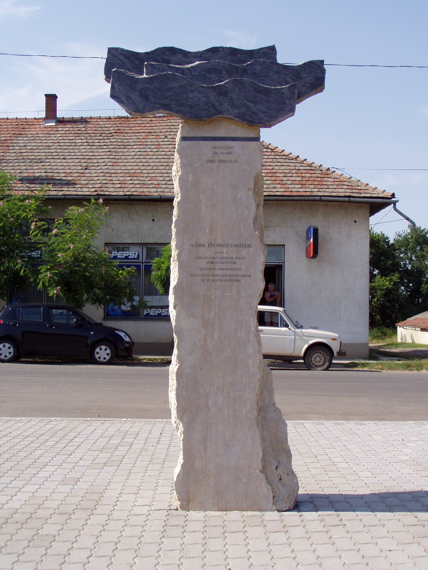
- Flood (Árvíz)
The inundation of a normally dry area caused by high flow, or overbank flow of water in an established watercourse, such as a river, stream, or drainage ditch; or ponding of water at or near the point where the rain fell. Floods inundate the floodplains of rivers.
Figure 4.1. Monument of the flood of 21 April 2006 at Szelevény, Hungary. [photo by Szabolcs Ákos Fábián]
- Flooding (Áradás)
Inundation of flat lands with a thin sheet of water during overbank flow.
- Fluid flow (Áramlás (vízmozgások))
The natural science of fluids (liquids and gases) in motion. In fluid dynamics, laminar flow is a flow regime characterized by high momentum diffusion and low momentum convection. In fluid dynamics, turbulence or turbulent flow is a flow regime characterized by chaotic and stochastic property changes. Laminar-turbulent transition is governed by the Reynolds number. The transition also occurs if the size of the object gradually increases, or if viscosity decreases, or if density increases.
- Food control, defence (Árvízvédelem)
Measures (usually building embankments) against flood damage. Planning, land acquisition, river channel maintenance, wetlands protection, and other regulations all help modify development on flood plains and watersheds to reduce their susceptibility to flood damage. Preventive measures are usually administered by the building, zoning, planning and/ or code enforcement offices of the local government.
- Ford (Gázló)
A shallow place where a river or stream may be crossed by wading or in a vehicle. Inflection zones between river bends.
- Fresh water (Édesvíz)
Terrestrial water that contains less than 1,000 milligrams per liter (mg/L) of dissolved solids; generally more than 500 mg/L is undesirable for drinking and many industrial uses.
- Geyser (Gejzír)
A spring characterized by intermittent discharge of water ejected turbulently and accompanied by a vapour phase (steam). Touristic attractions in volcanic areas.
- Glacier (Gleccser)
A large persistent body of ice. Originating on land, a glacier flows slowly due to stresses induced by its weight. Geomorphic action is partly due to the transport of till. The glacial valleys are U-shaped.
- Glint lake (Glinttavak)
A lake formed along a glint line, esp. a long, narrow glacial lake occupying a basin excavated in bedrock where a glacier is dammed by an escarpment ('glint"), e.g. Lake Ladoga, Great Lakes in North America.
- Groundwater (Felszín alatti vizek)
Located below the surface, groundwater fills in soil pore spaces and fractures of rock formations. Includes soil moisture, free surface or unconfined groundwater, confined groundwater, water in joints (including karstwater) and juvenile water.
- High water (Nagyvíz (jele: NV))
Above-average water stage for a river or lake.
- Holt (Berek)
An area of woodland in a shallow pond, e.g. a grove or copse.
- Hot spring (Hévforrás)
A spring produced by the emergence of geothermally heated groundwater from the Earth's crust. There are geothermal hot springs in many locations all over the crust of the earth.
- Hydrogeography (Hidrogeográfia)
Science concerned with the geographical distribution of water on Earth. It includes study of rivers or streams, creeks, lakes, ponds, marshes, springs, wells, underground water, irrigation projects, precipitation, and the like.
- Hydrogeoraphy (Vízföldrajz (hidrogeográfia))
Concerned with water whether surface or sub- surface in origin. It includes study of rivers or streams, creeks, lakes, ponds, marshes, springs, wells, underground water, irrigation projects, precipitation, and the like.
- Hydrology (Hidrológia)
The applied science of water, its physics and chemistry, reserves and circulation in the hydrological cycle: precipitation, consequent runoff, infiltration, and storage; eventual evaporation etc.
- Hydrometer (Hidrométer)
An instrument used to measure the specific gravity (or relative density) of liquids; that is, the ratio of the density of the liquid to the density of water.
- Hydrosphere (Hidroszféra)
The region that includes all the earth's liquid water, frozen water, floating ice, frozen upper layer of soil, and the small amounts of water vapor in the earth's atmosphere.
- Ice drift (Jégzajlás)
Movement of melting ice along a river, on a lake or sea. Ice floes are jammed by the wind.
- Ice sheet (Belföldi jég)
A mass of glacier ice that covers surrounding terrain and is greater than 50,000 km². The only current ice sheets are in Antarctica and Greenland. Icebergs calve from them. When melted, the water stored in ice sheets could significantly raise sea levels (see glaciations).
- Ice shelf (Selfjég)
A sheet of very thick ice, with a level or gently undulating surface, which is attached to the land along one side but most of which is afloat and bounded on the seaward side by a steep cliff (ice front) rising 2 to 50 m or more above sea level. Examples are the Ross, Ronne, Filchner and Amery ice shelves on Antarctica.
- Iceberg (Jéghegy)
A large mass of ice containing freshwater that has broken off (calved) from a glacier or ice shelf and is floating in open water, drifted southwards. Only 1/9 of the mass rises above the water surface.
- Ice-jam flood (Jeges árvíz)
Early spring floods on frozen rivers. Jammed ice floes impound water flow (like on the Danube in 1838 at Pest and in 1956 along the Lower Danube section.
- Industrial water (Ipari víz)
Industrial water is used for such purposes as fabricating, processing, washing, diluting, cooling, or transporting a product; incorporating water into a product; or for sanitation needs within the manufacturing facility.
- Inland sea (Beltenger)
A shallow sea that covers central areas of continents during periods of high sea level that result in marine transgressions. It has characteristic physica and chemical water properties and wildlife. There are intracontinental seas, like the Baltic Sea, and intercontinental seas, like the Mediterranean Sea.
- Joint water (Résvíz)
Groundwater in a crevice or fissure in solid rock. Includes karstwater in limestones.
- Juvenile water (Juvenilis víz)
Water which exists within and in equilibrium with a magma or water rich volatile fluids which are derived from a magma.
- Karst water (Karsztvíz)
Water stored in karstic rocks, dissolving them and issuing from karst springs. Chemical composition indicates that it has passed across and through karstic limestone.
- Kettle lake (Soll)
A body of water occupying a kettle (melt ice depression), on pitted outwash plains.
- Lakes (Tavak)
A body of relatively still fresh or salt water of considerable size, localized in a basin, not to be confused with a lagoon, that is surrounded by land. Lakes are inland and not part of the ocean, and are larger and deeper than ponds.
- Laminar flow (Párhuzamos áramlás)
Water flow in which the stream lines remain distinct and in which the flow direction at every point remains unchanged with time.
- Large river (Folyam)
Large rivers are at least 1000 km long, and have 150,000 km2 drainage area. Giant rivers are more than 2500 km long with at least 1 million km2 drainage area (e.g. the Danube
).- Limnology (Limnológia)
Also called freshwater science, is the study of inland waters.
- Littoral zone (Litorális öv)
That part of a sea, lake or river that is close to the shore (down to 150 m depth). In coastal environments the littoral zone extends from the high water mark, which is rarely inundated, to shoreline areas that are permanently submerged.
- Low water (Kisvíz (jele: KV))
The lowest level of water in a body of water, such as a river, lake, or reservoir as indicated on the river gauge.
- Lower course (Alsószakasz-jelleg)
The volume of water in a river is at its highest in the lower course. This is due to the contribution of water from tributaries. The river channel is shallow and wide and the land around the river is flat. Stream energy is lowest and deposition occurs.
- Maar (Maar)
A broad, low-relief volcanic crater that is caused by a phreatomagmatic (groundwater-induced) eruption. Usually forms a relatively shallow maar lake.
- Mareograph (Mareográf)
A device used to measure tidal levels.
- Marginal sea (Peremtenger (melléktenger))
A partially enclosed sea adjacent to or widely open to the open ocean, but bounded by submarine ridges.
- Marsh/Swamp (Mocsár)
A water-saturated, poorly drained area, intermittently or permanently water-covered, having aquatic and grass like vegetation, essentially without peat formation.
- Mean water (Közepes víz (jele: KÖV))
The average surface level of a body of water. Mathematical mean of water stages recorded to date.
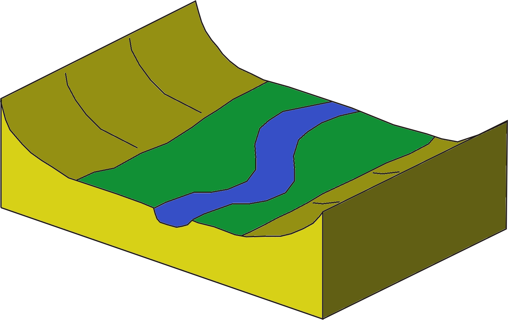
- Meander (Folyókanyarulat)
A meander in general is a bend in a sinuous watercourse. A meander is formed when the moving water in a stream erodes the outer banks and the channel shifts in the valley.
- Meandering (Meanderezés)
A stream having a pattern of successive meanders. Caused by the shifting of channel through accumulation on the convex banks and erosion on the concave banks. Cutoff meanders are called oxbows.
- Melting point (Olvadáspont)
The melting point of a solid is the temperature at which it changes state from solid to liquid.
- Mesotrophic lake (Fertő)
Lakes with an intermediate level of productivity, greater than oligotrophic lakes, but less than eutrophic lakes. Clear water lakes and ponds with beds of submerged aquatic plants and medium levels of nutrients.
- Middle course (Középszakasz-jelleg)
In the middle course the slope the river is reduced, the river begins to meander and the valley sides are also less steep. Both accumulation and erosion are typical. Example is the Danube in the Sárköz region before channelization.
- Mineral water (Ásványvizek)
Water containing minerals or other dissolved substances that alter its taste or give it therapeutic value, generally obtained from a naturally occurring mineral spring or source. Dissolved substances in the water may include various salts (J, Br, Na, Mg, Li etc.). In the U.S. mineral water contains at least 250 parts per million total dissolved solids. In Hungary the limit for commercial mineral water is 0.5 g/L (e.g. Theodora Kékkúti).
- Mouth (Torkolat)
The point at which the stream discharges, possibly via an estuary or delta, into a body of stagnant water such as a lake or ocean. The shape depends on the character of the river and the stagnant water body (wave action, currents and tides).
- Neap tide (Vakár)
A tide that occurs when the difference between high and low tide is least; the lowest level of high tide. Neap tide comes twice a month, in the first and third quarters of the moon.
- Neritic zone (Neritikus öv)
The coastal ocean or the sublittoral zone, part of the ocean extending from the low tide mark to the edge of the continental shelf, with a relatively shallow depth down to 200 meters.
- Oasis (Oázis)
In geography, an oasis is an isolated area of vegetation in a desert, typically surrounding a spring or similar water source.
- Ocean (Óceán)
A major body of saline water, and a principal component of the hydrosphere. The four oceans are the Pacific, Atlantic, Indian and Arctic.
- Oceanography (Tengertan)
The scientific study of oceans, the life that inhabits them, and their physical characteristics, including the depth and extent of ocean waters, their movement and chemical makeup, and the topography and composition of the ocean floors.
- Ogive (Ogiva)
In glaciology, ogives are three dimensional wave-bulges characteristic of glaciers that have experienced extreme underlying topographical change, observed as an ice fall.
- Pelagic zone (Pelágikus öv)
Any water in a sea or lake that is not close to the bottom or near to the shore can be said to be in the pelagic zone.
- Perennial stream (Állandó vízfolyás)
A stream which contains water at all times except during extreme drought.
- Permanent hardness (Állandó keménység)
Hardness in water is defined as concentration of multivalent cations. These cations include Ca2+ and Mg2+. The ions enter a water supply by leaching from minerals within an aquifer. Other types of calcium ion or magnesium ion in water such as calcium and magnesium sulfates are not removed by boiling and cause permanent hardness.
- Permeability (Vízátbocsátó képesség (permeabilitás))
In fluid mechanics and the earth sciences is a measure of the ability of a porous material (often, a rock or unconsolidated material) to allow fluids to pass through it. Darcy's law describes it.
- pH value (pH érték (pondus Hidrogenii))
In chemistry, pH is the exponent of the concentration of H ions, a measure of the acidity or basicity of an aqueous solution or of soils. Clear water is pH 7.
- Plankton (Plankton)
Collective term for drifting organisms (animals, plants, archaea, or bacteria) that inhabit the pelagic zone of oceans, seas, or bodies of fresh water. Plankton are defined by their ecological niche rather than phylogenetic or taxonomic classification.
- Polder (Polder)
A low-lying tract of artificially drained land enclosed by embankments (barriers). An artificial hydrological entity, connected to sea through sluices.
- Polluted water (Szennyezett vizek)
Degraded by a substance or condition, the water fails to meet specified standards or cannot be used for a specific purpose.
- Ponding, excess water (Belvíz)
In flat areas, runoff collects, or ponds in depressions without drainage. Flood waters must infiltrate slowly into the soil, evaporate, or be pumped out. Oversaturation of the soil is detrimental to plants. Excess water can be drained through dykes and pumping. The drainage network in Hungary is almost 43,000 km long.
- Pothole, cauldron (Üst)
A hollow in the bed of a stream caused by erosion, particularly at the feet of waterfalls.
- Precipitation intensity (Csapadékintenzitás)
The rate at which rain falls, usually measured in millimetres per hour. Intense rainfall is associated with convectional rain, notably in thunderstorms and tropical regions, where intensity may be over 100 mm per hour. In Hungary highest daily intensity was 260 mm (at Dad) and hourly 120 mm (at Heves).
- Recession/fall (Apadás)
When water stage is falling in a stream or discharge is decreasing.
- Reflection (Reflexió)
The change in direction of a wavefront at an interface between two different media so that the wavefront returns into the medium from which it originated.
- Regelation (Regeláció)
Freeze-thaw alterations, melting under pressure and freezing again when the pressure is reduced. Important in glacier motion.
- Regression (Regresszió)
The retreat or contraction of the sea from land areas, and the consequent evidence of such withdrawal (such as enlargement of the area of deltaic deposition).
- Reservoir (Víztározó medence (ciszterna))
An artificial lake used to store water. Reservoirs may be created in river valleys by the construction of a dam or may be built by excavation in the ground or by conventional construction techniques such as brickwork or cast concrete.
- Resurgent (Mélységi víz)
Magmatic water or gases derived from sources on the Earth's surface, from the atmosphere, or from country rock adjacent to the magma.
- Resurgent stream (Búvópatak)
A stream which flows underground through a complex series of caves and eventually works its way down to a level of impermeable rock or resurfaces.
- Reynolds number (Reynolds szám)
In fluid mechanics, the Reynolds number Re is a dimensionless number that gives a measure of the ratio of inertial forces to viscous forces and consequently quantifies the relative importance of these two types of forces for given flow conditions.
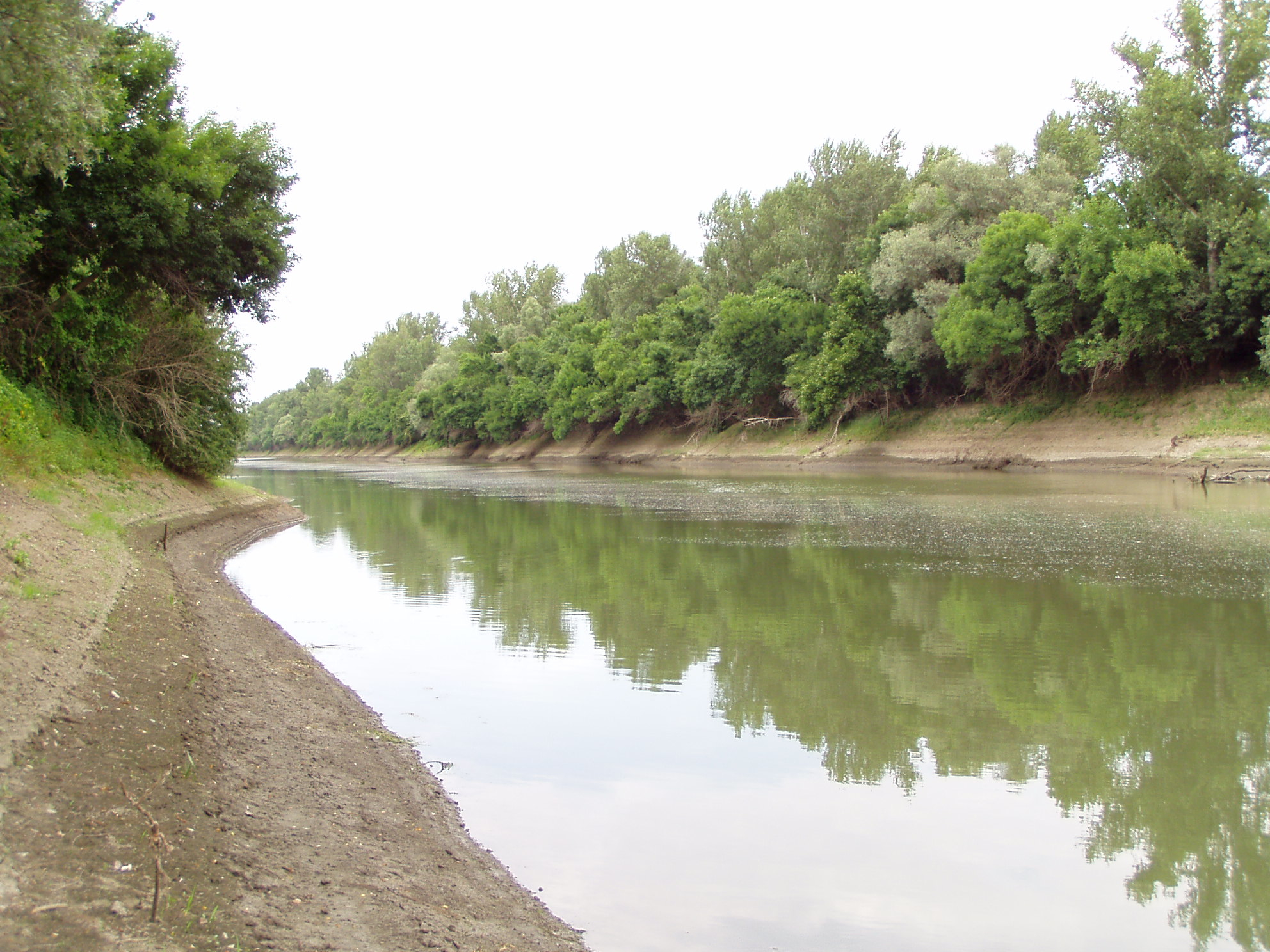
- River (Folyó)
A natural watercourse, usually freshwater, flowing towards an ocean, a lake, a sea, or another river. Intermittent rivers dry up completely before reaching the sea.
- River bifurcation (Bifurkáció)
Occurs when a river flowing in a single stream separates into two or more separate streams (called distributaries) which continue downstream. Famous example is the Casiquiare between the Orinoco and the Rio Negro (Amazon).
- River capture, beheading (Kaptúra (folyólefejeződés))
A geomorphological phenomenon occurring when a stream or river drainage system or watershed comes into contact with another and is diverted from its own bed, and flows instead along the bed of a neighbouring stream. In the case of bathycapture the surface stream disappears underground and a dry bed is left behind.
- River Forecast (Előrejelzés)
An internal product issued by RFCs to other NWS offices. An RVF contains stage and/or flow forecasts for specific locations based on existing, and forecasted hydrometeorologic conditions. The contents of these products are used by the HSA office to prepare Flood Warnings (FLW), Flood Statements (FLS), River Statements (RVS), as well as other products available to the public: http://www.hydroinfo.hu
- River mechanism (Szakaszjelleg)
The flow characteristics of a stream; the habits of an individual stream (including low flows and floods) with respect to such quantities as velocity, volume, form of and changes in the channel, capacity to transport sediment, and geomorphic action.
- River regime (Vízjárás)
The variability in its discharge throughout the course of a year in response to precipitation, temperature, evapotranspiration, and drainage basin characteristics. A series of characteristic power-law relationships between discharge and width, depth, and slope.
- Runoff (Lefolyás)
The water flow that occurs when soil is infiltrated to full capacity and excess water from rain, meltwater, or other sources flows over the land.
- Salt pan (Sós tavak)
Ephemeral lakebeds, or remnants of an endorheic lake. Such flats consist of fine-grained sediments infused with alkali salts. Also referred to as alkali flats, sabkhas, playas, salt pans, pans, hardpan or salt flats.
- Saltation (Szaltáció)
A mode of sediment transport in which the particles are moved progressively forward in a series of short intermittent leaps, jumps, hops, or bounces from a bottom surface. Occurs in deserts (sand particles skipping downwind by impact and rebound) and in streams under the influence of eddy currents that are not turbulent enough to retain the particles in suspension.
- Sapropel (Szapropél)
An unconsolidated, jellylike ooze or sludge composed of plant remains, most often algae, accumulating in an anaerobic environment on the shallow bottoms of lakes and seas.
- Sea (Tenger)
Generally refers to a large body of salt water, but the term is used in other contexts as well. Most commonly, it refers to a large expanse of saline water connected with an ocean. Sometimes lakes (the Caspian or the Dead Sea) are called seas.
- Sea level (Tengerszint)
A measure of the average height of the ocean's surface (such as the halfway point between the mean high tide and the mean low tide); used as a standard in reckoning land elevation. The level of the Baltic Sea is ca 60 m higher than the Adriatic Sea.
- Sea wave (Tengerhullámzás)
A series of orbitoidally moving water particles. For its characterization wave length (max. 200-250 m), period (max. 15-20 m) and speed (20-25 m/s) are used. Tsunami waves reach the greatest dimensions.
- Seiche (Seiche)
Large-scale standing waves observed on lakes, reservoirs, swimming pools, bays, harbors and seas. The key requirement for formation of a seiche is that the body of water be at least partially bounded. First described by François-Alphonse Forel on Lake Geneva.
- Sewage treatment (Szennyvíztisztítás)
The process of removing contaminants from wastewater and household sewage, both runoff (effluents) and domestic. It includes physical, chemical, and biological processes to remove physical, chemical and biological contaminants. Its objective is to produce an environmentally-safe fluid waste stream (or treated effluent) and a solid waste (or treated sludge) suitable for disposal or reuse (usually as farm fertilizer). The treatment and draining of sewage are controlled by 25/2002 and 26/2002 Government Regulations in Hungary.
- Siphon (Szifon)
In speleology, a siphon is that part of a cave passage that lies under water and through which cavers have to dive to progress along it.
- Snow line (Hóhatár)
The climatic snow line is the point above which snow and ice cover the ground throughout the year. The actual snow line may seasonally be significantly lower. The elevation of the snow line is gradually dropping from the Equator towards the poles.
- Specific runoff (Fajlagos lefolyás)
Loss of rain, spring and groundwater from a unit are during a unit time. An important data for water management, measured in L/s/km2.
- Speleology (Speleológia)
The scientific study of caves and other karst features, their origin, structure, physical properties, history, life forms.
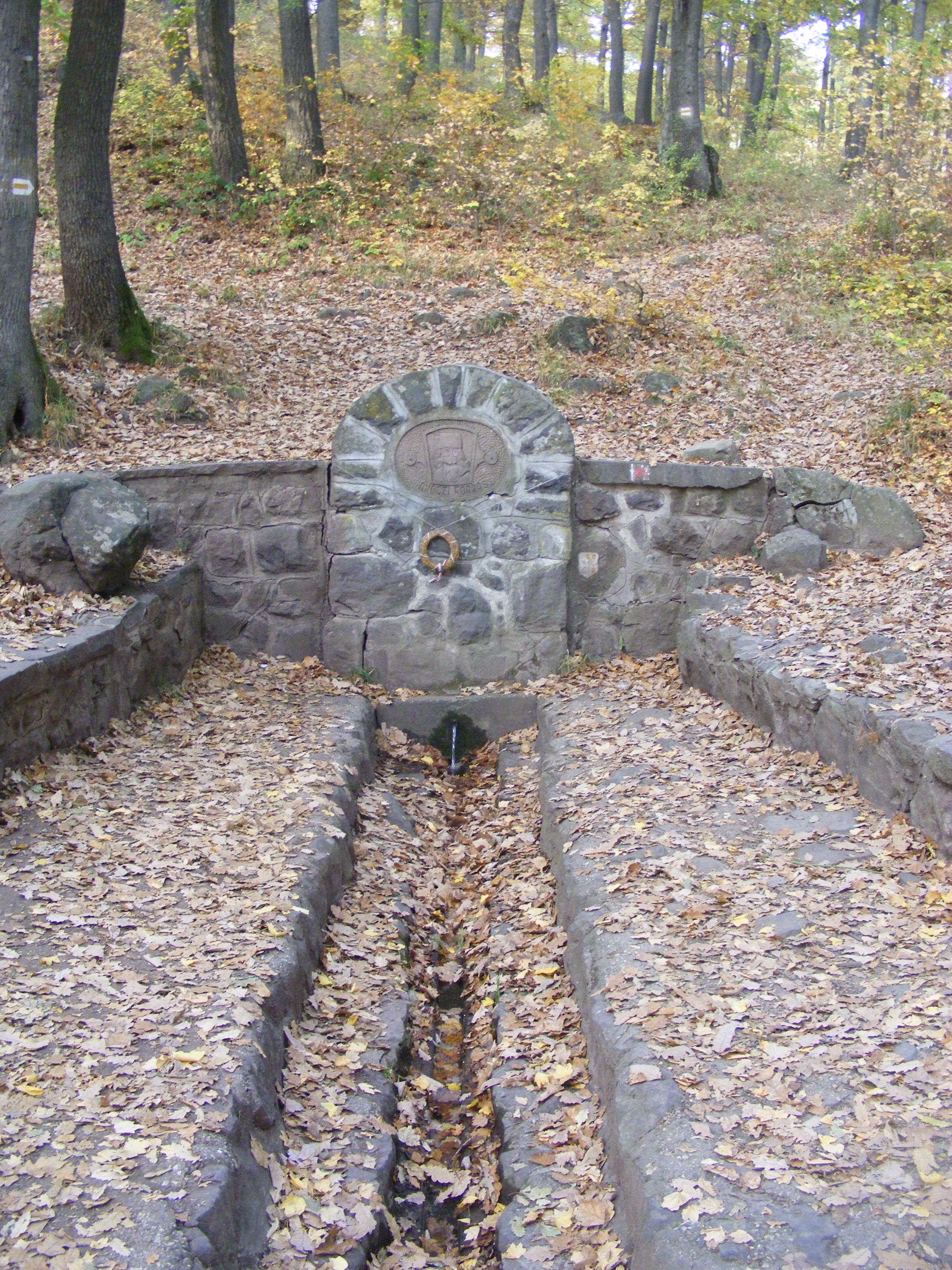
- Spring (Forrás)
The point where water issues from underground. Types are identified on the basis of geological, biological, chemical, physical properties or by practical use or permanent nature.
- Spring flood (Zöldár)
Characteristic spring flood in Hungarian rivers; named after the vegetation drifted by the river.
- Stagnant water (Állóvíz (~ részei))
Motionless water, not flowing in a stream or current, in well-defined basin, fed or connected by rivers. Includes lakes and wetlands (swamps, moors).
- Standing wave (Állóhullám)
Caused by the interference of waves of the same frequency and amplitude in an enclosed or partially enclosed body of water. A standing or stationary wave remains in a constant position. Enduring unidirectional wind or pressure change induce standing waves.
- Storage (Tározás)
Some runoff water is trapped for periods of time, for example in lakes or reservoirs for flood control, drinking water supply or industrial purposes. The largest reservoir in Hungary is Lake Tisza.
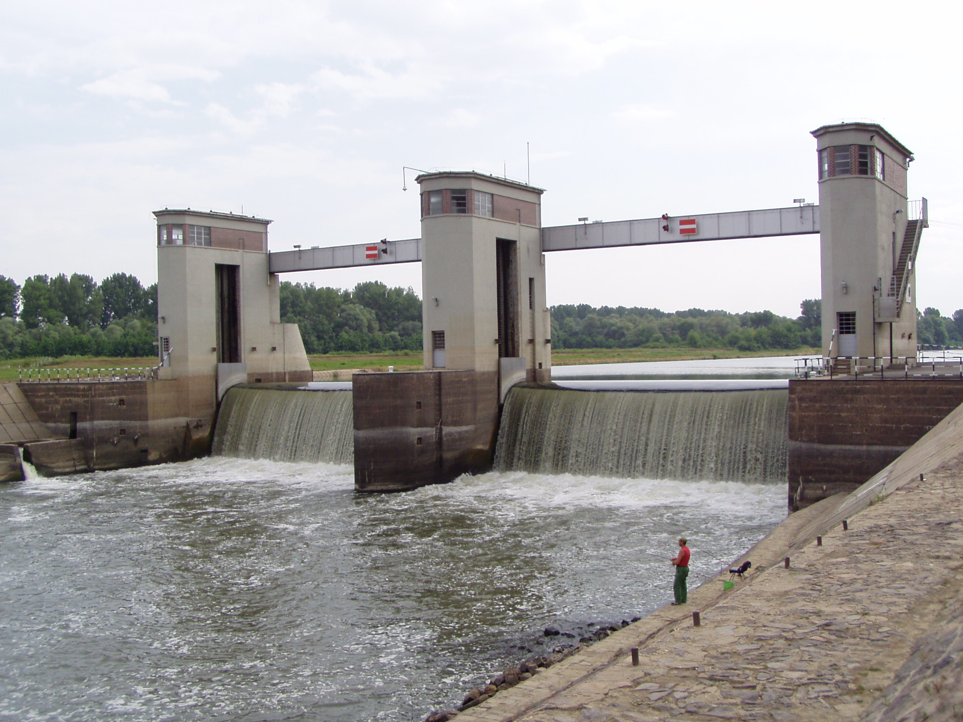
Figure 4.6. The Békésszentandrás Dam, built for navigation and electricity generation (none of these functions are realized) [photo by Szabolcs Ákos Fábián]
- Storm surge (Vihardagály)
An offshore rise of water associated with a low pressure weather system, typically tropical cyclones and strong extratropical cyclones. Common on the North Sea.
- Strait (Tengerszoros)
A narrow, navigable channel of water that connects two larger navigable bodies of water. It most commonly refers to a channel of water that lies between two land masses, also a navigable channel through a body of water that is otherwise not navigable (reef or archipelago).
- Stream (Patak)
A small to medium sized natural watercourse.
- Stream flow/discharge (Vízhozam)
The volume of water which passes through a given cross-section of the river channel per unit time. It is typically measured in cubic meters per second (cumec); it is sometimes also measured in litres per second.
- Stream load (Hordalék)
The solid or dissolved matter carried by a stream.
- Subsurface flow (Vízáramlás)
The flow of water underground, in the vadose zone and aquifers.
- Surface waters (Felszíni vizek)
Surface waters collect on the ground or in a streams, rivers, lakes, wetlands, or oceans; communicates with both groundwater and atmospheric water. In a broader sense includes polar and mountain ice sheets and caps.
- Surface wave (Felületi hullámok)
A mechanical wave resulting from the orbitoid motion of fluid particles that propagates along interfaces between fluids and the air.
- Suspended load (Lebegtetett hordalék)
Sediment load which settles slowly enough to be carried in streams either without touching the bed or while only intermittently touching it.
- Thalweg (Esésgörbe)
The line connecting the lowest or deepest points along a stream bed or valley, whether under water or not; the longitudinal profile of a stream or valley; the line of maximum depth.
- Thalweg (Sodorvonal)
The line of the fastest current or the strongest flow of a stream. The deepest zone of the river bed.
- Thermal water (Termálvíz)
Water, generally of a spring or geyser, whose temperature is appreciably above the local mean annual air temperature.
- Tide (Árapály (tengerjárás))
The rise and fall of sea levels caused by the combined effects of the gravitational forces exerted by the Moon and the Sun and the rotation of the Earth. There is a 12.5-hour periodicity between high and low tides. Tides are influenced by sea-floor topography and the dissection of coasts. Spring tide occurs at new and full moon, while neap tide at the first and last quarters.
- Torrent (Torrens)
Watercourses of great slope and irregular regime, capable of intensive flooding, usually in semiarid and arid or mountainous and foothill areas.
- Transgression (Transzgresszió)
The spread or extension of the sea over land areas, and the consequent evidence of such advance (such as strata deposited unconformably on older rocks, esp. where the new marine deposits are spread far and wide over the former land surface).
- Tsunami (Cunami (szökőár))
A series of high waves caused by the displacement of a large volume of a body of water, usually in oceans.. Earthquakes, volcanic eruptions and underwater explosions, landslides glacier calvings and other mass movements, meteorite ocean impacts or similar impact events, and other disturbances above or below water all have the potential to generate a tsunami. Waves can be up to 35 m high, in straits even higher.
- Unconfined groundwater (Talajvíz)
Water located beneath the ground surface in soil pore spaces and in the fractures of rock formations. Recharged from rainwater and rivers, groundwater flows in the dip direction of the underlying impervious layer and its table is fluctuating.
- Upper course (Felsőszakasz-jelleg)
The uppermost river section in mountains or hills. Here the river erodes a V-shaped valley, the channel is fairly straight and slope is great. The prevailing geomorphic process is incision, the landforms common along this course of the river are waterfalls and gorges.
- Vadose water (Vadózus víz
Water in the zone of aeration. Also known as kremastic water; suspended water; wandering water.
- Wadden Sea (Watt-tengerek)
A spring of abundant yield rising up a deep, steeply-inclined, water-filled passage into a small surface pool. Named after a spring at the foot of Mt. Ventoux, France.
- Wadi (Vádi)
The Arabic term traditionally referring to a valley. A dry (ephemeral) riverbed that contains water only during times of heavy rain or simply an intermittent stream.
- Water budget (Vízháztartás)
In hydrology, a water budget equation can be used to describe the flow of water in and out of a system. It depends on climate, vegetation, geology and topography.
- Water conservation (Vízvédelem)
Reducing the usage of water and recycling of waste water for different purposes such as cleaning, manufacturing, and agricultural irrigation.
- Water depth (Vízmélység)
The study of underwater depth of lake or ocean floors.
- Water gauge (Vízmérce)
An instrument for measuring and recording automatically the rise and fall of a river. The zero level indicates the lowest water stage ever recorded. Black and white strips at 2 cm intervals and marking at 10 cm intervals allow easy reading.
- Water hardness (Vízkeménység)
Hardness in water is defined as concentration of multivalent cations. Multivalent cations are cations (positively charged metal complexes) with a charge greater than 1+. They mainly have the charge of 2+. These cations include Ca2+ and Mg2+. These ions enter a water supply by leaching from minerals within an aquifer. Common calcium-containing minerals are calcite and gypsum. A common magnesium mineral is dolomite (which also contains calcium). Rainwater and distilled water are soft, because they also contain few ions.
- Water level (Vízszint)
The level of the surface of a body of water.
- Water management (Vízgazdálkodás)
The activity of planning, developing, distributing and managing the optimum use of water resources.
- Water stage (Vízállás)
The height of a water surface above an arbitrarily established datum plane. Water gauges record water regime, the succession of water stages throughout the year, and provide important information for flood control and inland navigation.
- Water storage (Víztárolás)
Some runoff water is trapped for periods of time, for example in lakes or reservoirs.
- Water supply (Vízellátás)
The provision by public utilities, commercial organisations, community endeavours or by individuals of water, usually by a system of pumps and pipes.
- Water/hydrological cycle (Víz körforgása)
The continuous circulation of water on, above and below the surface of the Earth. Water can change states among liquid, vapor, and ice at various places in the water cycle.
- Watercourse (Vízfolyás (folyó víz))
A watercourse is any flowing body of water. These include rivers, streams, anabranches, and so forth.
- Water-gauge (Vízszintmérő)
An instrument indicating the level of water, as in a boiler, tank, reservoir, or stream.
- Water-level fluctuation (Vízjáték)
Disparity between the level of the winter and summer water table is known as the zone of intermittent saturation, wherein the water table will fluctuate in response to climatic conditions.
- Wave motion (Hullámmozgás)
Waves travel and the wave motion transfers energy from one point to another, often with no permanent displacement of the particles of the medium.
- Zuiderzee Works (Zuidersee-program)
A man-made system of dams, land reclamation and water drainage works, the largest hydraulic engineering project undertaken by the Netherlands during the twentieth century. The project involved the damming of the Zuiderzee, a large, shallow inlet of the North Sea, and the reclamation of land in the newly enclosed water using polders. Its main purposes are to improve flood protection and create additional land for agriculture and new cities (Lelystad, Almere) was established as well.